Area Overview for YO17 6RY
Photos of YO17 6RY
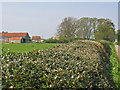
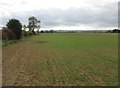
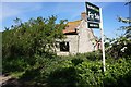
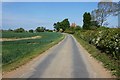
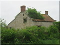
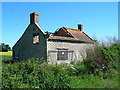
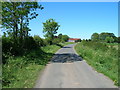
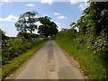
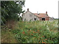
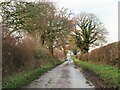
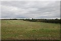
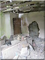
13 photos from this area
Area Information
Key information about the YO17 6RY including its size, population, and administrative classification.
- Area Type
- Postcode
- Area Size
- 2.6 km²
- Population
- 1901
- Population Density
- 41 people/km²
House Prices in YO17 6RY
15
Properties
£476,800
Average Sold Price
£300,000
Lowest Price
£730,000
Highest Price
Showing 15 properties
| Address | Type | Beds | Baths | Last Sale Price | Last Sale Date | |
|---|---|---|---|---|---|---|
| Chestnut House, Ryton Rigg Road, Ryton, YO17 6RY | Detached | 3 | - | £300,000 | Mar 2021 | |
| Garforth Hall, Ryton Rigg Road, Ryton, YO17 6RY | house | - | - | £550,000 | Nov 2020 | |
| Manor Farm, Ryton Rigg Road, Ryton, YO17 6RY | Detached | 4 | 3 | £730,000 | Sep 2019 | |
| Crathie House, Ryton Rigg Road, Ryton, YO17 6RY | house | - | - | £305,000 | Oct 2017 | |
| Ryton Grange, Ryton Rigg Road, Ryton, YO17 6RY | Detached | 5 | 2 | £499,000 | Sep 2005 | |
| The Smithy, Ryton Rigg Road, Ryton, YO17 6RY | Detached | 3 | 2 | - | - | |
| Garthforth Hall Cottage, Ryton Rigg Road, Ryton, YO17 6RY | Detached | - | - | - | - | |
| Low Farm, Ryton Rigg Road, Ryton, YO17 6RY | Detached | 3 | 1 | - | - | |
| Brass Castle, Low Farm, Ryton Rigg Road, Ryton, YO17 6RY | Detached | - | - | - | - | |
| Cherry Tree Cottage, Ryton Rigg Road, Ryton, YO17 6RY | Detached | 3 | - | - | - |
Page 1 of 2
Energy Efficiency in YO17 6RY
Amenities
Schools
| Rank | School | Type | Entry gender | Ages |
|---|
Explore more schools in this area
Go to Schools tabDemographics
Household Size
Two person
most common
Accommodation Type
Houses
most common
Tenure
76
majority
Ethnic Group
White
most common
Religion
N/A
most common
Household Composition
N/A
most common
Age
47
median
Adults (30-64 years)
most common
Household Deprivation
N/A
with no deprivation
NS-SEC
34
in Lower managerial occupations
Explore more demographic insights in this area
Go to Demographics tabPlanning
Planning Constraints
- Flood RiskPremium
- Ramsar Wetland SitesPremium
- Area of Outstanding Natural BeautyPremium
- Protected Nature ReservePremium
- Protected WoodlandPremium