Area Overview for YO17 6AX
Photos of YO17 6AX
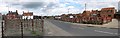
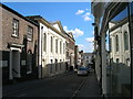
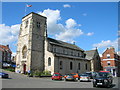
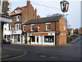
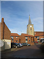
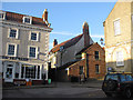
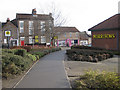
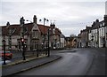
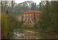
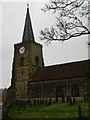
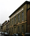
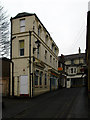
100 photos from this area
Area Information
Key information about the YO17 6AX including its size, population, and administrative classification.
- Area Type
- Postcode
- Area Size
- 12.7 hectares
- Population
- 1583
- Population Density
- 892 people/km²
House Prices in YO17 6AX
30
Properties
£482,964
Average Sold Price
£60,000
Lowest Price
£1,250,000
Highest Price
Showing 30 properties
| Address | Type | Beds | Baths | Last Sale Price | Last Sale Date | |
|---|---|---|---|---|---|---|
| Rudstone House, 15 York Road, Malton, YO17 6AX | Detached | 4 | 2 | £695,000 | Dec 2024 | |
| Beech Brow, 31 York Road, Malton, YO17 6AX | house | - | - | £1,250,000 | Sep 2023 | |
| Derwent Mount, 6 York Road, Malton, YO17 6AX | house | - | - | £795,000 | Jul 2016 | |
| 4 York Road, Malton, YO17 6AX | Detached | 7 | 2 | £530,000 | Jul 2016 | |
| The Brow, 25 York Road, Malton, YO17 6AX | house | 2 | 2 | £300,000 | Apr 2015 | |
| Arncliffe, 8 York Road, Malton, YO17 6AX | Semi-detached | - | - | £705,000 | Jun 2007 | |
| The Browse, 43 York Road, Malton, YO17 6AX | Semi-detached | - | - | £565,000 | Dec 2006 | |
| The Coach House, 37 York Road, Malton, YO17 6AX | Detached | 3 | 2 | £320,000 | Mar 2006 | |
| The Woodlands, 9 York Road, Malton, YO17 6AX | house | - | - | £750,000 | Nov 2004 | |
| An Bruachan, 41 York Road, Malton, YO17 6AX | house | 4 | 3 | £360,000 | Jul 2004 |
Page 1 of 3
Energy Efficiency in YO17 6AX
Amenities
Schools
| Rank | School | Type | Entry gender | Ages |
|---|
Explore more schools in this area
Go to Schools tabDemographics
Household Size
Two person
most common
Accommodation Type
Houses
most common
Tenure
85
majority
Ethnic Group
White
most common
Religion
N/A
most common
Household Composition
N/A
most common
Age
47
median
Adults (30-64 years)
most common
Household Deprivation
N/A
with no deprivation
NS-SEC
44
in Lower managerial occupations
Explore more demographic insights in this area
Go to Demographics tabPlanning
Planning Constraints
- Flood RiskPremium
- Ramsar Wetland SitesPremium
- Area of Outstanding Natural BeautyPremium
- Protected Nature ReservePremium
- Protected WoodlandPremium