Area Overview for YO14 0PS
Photos of YO14 0PS
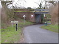
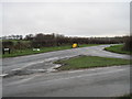
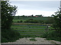
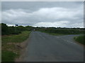
86 photos from this area
Area Information
Key information about the YO14 0PS including its size, population, and administrative classification.
- Area Type
- Postcode
- Area Size
- 5.9 hectares
- Population
- 1570
- Population Density
- 1551 people/km²
House Prices in YO14 0PS
9
Properties
£335,000
Average Sold Price
£240,000
Lowest Price
£415,000
Highest Price
Showing 9 properties
| Address | Type | Beds | Baths | Last Sale Price | Last Sale Date | |
|---|---|---|---|---|---|---|
| 10 Sheepdyke Lane, Hunmanby, Filey, YO14 0PS | Detached | 4 | 2 | £415,000 | Mar 2024 | |
| 12 Sheepdyke Lane, Hunmanby, Filey, YO14 0PS | house | - | - | £355,000 | Jan 2019 | |
| 8 Sheepdyke Lane, Hunmanby, Filey, YO14 0PS | Detached | 4 | 2 | £240,000 | Aug 2009 | |
| 3 Sheepdyke Lane, Hunmanby, Filey, YO14 0PS | Bungalow | 3 | 1 | £395,000 | Mar 2005 | |
| 14 Sheepdyke Lane, Hunmanby, Filey, YO14 0PS | Detached | - | - | £270,000 | Nov 2004 | |
| Pinfold Lodge Nursing And Residential Home, 6 Sheepdyke Lane, Hunmanby, Filey, YO14 0PS | Retirement | - | - | - | - | |
| The Paddocks, Sheepdyke Lane, Hunmanby, Filey, YO14 0PS | Detached | - | - | - | - | |
| 1 Sheepdyke Lane, Hunmanby, Filey, YO14 0PS | Bungalow | - | - | - | - | |
| Bungalow With Livery Stable, Sheepdyke Lane, Hunmanby, Filey, YO14 0PS | undefined | - | - | - | - |
Energy Efficiency in YO14 0PS
Amenities
Schools
| Rank | School | Type | Entry gender | Ages |
|---|
Explore more schools in this area
Go to Schools tabDemographics
Household Size
Two person
most common
Accommodation Type
Houses
most common
Tenure
84
majority
Ethnic Group
White
most common
Religion
N/A
most common
Household Composition
N/A
most common
Age
47
median
Adults (30-64 years)
most common
Household Deprivation
N/A
with no deprivation
NS-SEC
28
in Lower managerial occupations
Explore more demographic insights in this area
Go to Demographics tabPlanning
Planning Constraints
- Flood RiskPremium
- Ramsar Wetland SitesPremium
- Area of Outstanding Natural BeautyPremium
- Protected Nature ReservePremium
- Protected WoodlandPremium