Area Overview for YO13 9JJ
Photos of YO13 9JJ

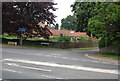
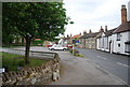
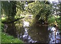
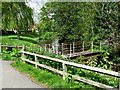
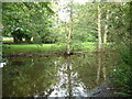
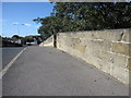
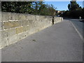
100 photos from this area
Area Information
Key information about the YO13 9JJ including its size, population, and administrative classification.
- Area Type
- Postcode
- Area Size
- 14.6 hectares
- Population
- 1706
- Population Density
- 160 people/km²
House Prices in YO13 9JJ
48
Properties
£221,834
Average Sold Price
£63,250
Lowest Price
£500,000
Highest Price
Showing 48 properties
| Address | Type | Beds | Baths | Last Sale Price | Last Sale Date | |
|---|---|---|---|---|---|---|
| 47 Garth End Road, West Ayton, Scarborough, YO13 9JJ | Semi-detached | 2 | 1 | £160,000 | Jan 2024 | |
| 53 Garth End Road, West Ayton, Scarborough, YO13 9JJ | Terraced | 4 | 2 | £270,000 | May 2023 | |
| 57 Garth End Road, West Ayton, Scarborough, YO13 9JJ | house | - | - | £160,000 | Dec 2022 | |
| 69 Garth End Road, West Ayton, Scarborough, YO13 9JJ | Semi-detached | 3 | 2 | £370,000 | Mar 2021 | |
| 71 Garth End Road, West Ayton, Scarborough, YO13 9JJ | Equestrian | 5 | 3 | £500,000 | Oct 2020 | |
| 5 Garth End Road, West Ayton, Scarborough, YO13 9JJ | house | - | - | £260,000 | Jul 2020 | |
| 17 Garth End Road, West Ayton, Scarborough, YO13 9JJ | Detached | 3 | 1 | £190,000 | Apr 2020 | |
| 49 Garth End Road, West Ayton, Scarborough, YO13 9JJ | Bungalow | 2 | 2 | £164,000 | Nov 2019 | |
| 19 Garth End Road, West Ayton, Scarborough, YO13 9JJ | house | - | - | £190,000 | May 2019 | |
| 101 Garth End Road, West Ayton, Scarborough, YO13 9JJ | Detached | 6 | 3 | £420,000 | Apr 2019 |
Page 1 of 5
Energy Efficiency in YO13 9JJ
Amenities
Schools
| Rank | School | Type | Entry gender | Ages |
|---|
Explore more schools in this area
Go to Schools tabDemographics
Household Size
Two person
most common
Accommodation Type
Houses
most common
Tenure
86
majority
Ethnic Group
White
most common
Religion
N/A
most common
Household Composition
N/A
most common
Age
47
median
Adults (30-64 years)
most common
Household Deprivation
N/A
with no deprivation
NS-SEC
32
in Lower managerial occupations
Explore more demographic insights in this area
Go to Demographics tabPlanning
Planning Constraints
- Flood RiskPremium
- Ramsar Wetland SitesPremium
- Area of Outstanding Natural BeautyPremium
- Protected Nature ReservePremium
- Protected WoodlandPremium