Area Overview for YO13 9BL
Photos of YO13 9BL
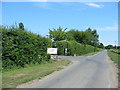
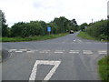
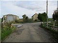
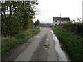
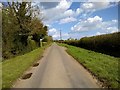
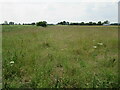
10 photos from this area
Area Information
Key information about the YO13 9BL including its size, population, and administrative classification.
- Area Type
- Postcode
- Area Size
- 17.9 hectares
- Population
- 1387
- Population Density
- 38 people/km²
House Prices in YO13 9BL
11
Properties
£418,200
Average Sold Price
£201,000
Lowest Price
£772,500
Highest Price
Showing 11 properties
| Address | Type | Beds | Baths | Last Sale Price | Last Sale Date | |
|---|---|---|---|---|---|---|
| 3, Stables Court, Green Lane, Snainton, Scarborough, YO13 9BL | house | 4 | 2 | £522,500 | Dec 2024 | |
| South Lodge Farm, Green Lane, Snainton, Scarborough, YO13 9BL | Detached | 4 | 3 | £772,500 | Aug 2022 | |
| Willow Garth, Green Lane, Snainton, Scarborough, YO13 9BL | Bungalow | 4 | 2 | £370,000 | Sep 2007 | |
| Thorn Park, Green Lane, Snainton, Scarborough, YO13 9BL | Detached | - | - | £225,000 | Aug 2004 | |
| South View Farm, Green Lane, Snainton, Scarborough, YO13 9BL | Bungalow | - | - | £201,000 | Jul 2001 | |
| 1, Paddock House, Stables Court, Green Lane, Snainton, Scarborough, YO13 9BL | Farm | 4 | 2 | - | - | |
| Carr House, Green Lane, Snainton, Scarborough, YO13 9BL | Bungalow | 3 | 1 | - | - | |
| Annexe At, Willow Garth, Green Lane, Snainton, Scarborough, YO13 9BL | Bungalow | - | - | - | - | |
| South View, Pig Farm, Station Road, Snainton, Scarborough, YO13 9BL | undefined | - | - | - | - | |
| Thorn Park Granny Annex, Green Lane, Snainton, Scarborough, YO13 9BL | undefined | - | - | - | - |
Page 1 of 2
Energy Efficiency in YO13 9BL
Amenities
Schools
| Rank | School | Type | Entry gender | Ages |
|---|
Explore more schools in this area
Go to Schools tabDemographics
Household Size
Two person
most common
Accommodation Type
Houses
most common
Tenure
78
majority
Ethnic Group
White
most common
Religion
N/A
most common
Household Composition
N/A
most common
Age
47
median
Adults (30-64 years)
most common
Household Deprivation
N/A
with no deprivation
NS-SEC
34
in Lower managerial occupations
Explore more demographic insights in this area
Go to Demographics tabPlanning
Planning Constraints
- Flood RiskPremium
- Ramsar Wetland SitesPremium
- Area of Outstanding Natural BeautyPremium
- Protected Nature ReservePremium
- Protected WoodlandPremium