Area Overview for YO13 9AB
Photos of YO13 9AB
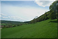
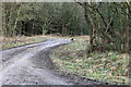
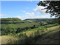
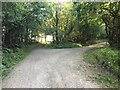
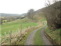
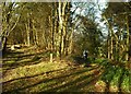
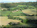
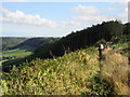
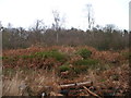
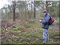
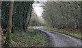
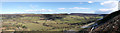
17 photos from this area
Area Information
Key information about the YO13 9AB including its size, population, and administrative classification.
- Area Type
- Postcode
- Area Size
- 3.0 km²
- Population
- 1687
- Population Density
- 45 people/km²
House Prices in YO13 9AB
54
Properties
£335,915
Average Sold Price
£123,650
Lowest Price
£480,000
Highest Price
Showing 54 properties
| Address | Type | Beds | Baths | Last Sale Price | Last Sale Date | |
|---|---|---|---|---|---|---|
| Shortgate Cottage, Wrench Green, Hackness, Scarborough, YO13 9AB | Detached | 2 | 1 | £280,000 | Feb 2025 | |
| Valley View, Wrench Green, Hackness, Scarborough, YO13 9AB | Semi-detached | 3 | 2 | £450,000 | Jun 2021 | |
| Derwent Dale, Wrench Green, Hackness, Scarborough, YO13 9AB | Detached | 5 | 1 | £480,000 | Jul 2018 | |
| Dale Cottage, Wrench Green, Hackness, Scarborough, YO13 9AB | house | - | - | £360,000 | Mar 2018 | |
| Cockrah Foot House, Wrench Green, Hackness, Scarborough, YO13 9AB | house | - | - | £410,000 | Nov 2015 | |
| Chapel Cottage, Wrench Green, Hackness, Scarborough, YO13 9AB | Detached | 1 | 1 | £148,000 | Oct 2013 | |
| Pear Tree Cottage, Wrench Green, Hackness, Scarborough, YO13 9AB | house | 3 | - | £395,000 | Sep 2013 | |
| The Little Portion, Wrench Green, Hackness, Scarborough, YO13 9AB | house | 3 | - | £380,000 | Nov 2011 | |
| Hunters Cottage, Wrench Green, Hackness, Scarborough, YO13 9AB | Semi-detached | - | - | £332,500 | May 2007 | |
| The Old Chapel, Wrench Green, Hackness, Scarborough, YO13 9AB | Detached | - | - | £123,650 | Mar 1998 |
Page 1 of 6
Energy Efficiency in YO13 9AB
Amenities
Schools
| Rank | School | Type | Entry gender | Ages |
|---|
Explore more schools in this area
Go to Schools tabDemographics
Household Size
Two person
most common
Accommodation Type
Houses
most common
Tenure
70
majority
Ethnic Group
White
most common
Religion
N/A
most common
Household Composition
N/A
most common
Age
47
median
Adults (30-64 years)
most common
Household Deprivation
N/A
with no deprivation
NS-SEC
34
in Lower managerial occupations
Explore more demographic insights in this area
Go to Demographics tabPlanning
Planning Constraints
- Flood RiskPremium
- Ramsar Wetland SitesPremium
- Area of Outstanding Natural BeautyPremium
- Protected Nature ReservePremium
- Protected WoodlandPremium