Area Overview for YO12 6UN
Photos of YO12 6UN
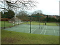
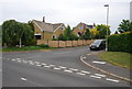
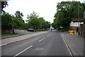
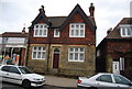
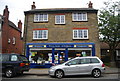
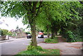
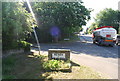
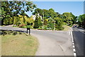

100 photos from this area
Area Information
Key information about the YO12 6UN including its size, population, and administrative classification.
- Area Type
- Postcode
- Area Size
- 1.8 hectares
- Population
- 1221
- Population Density
- 1123 people/km²
House Prices in YO12 6UN
24
Properties
£258,141
Average Sold Price
£106,250
Lowest Price
£465,000
Highest Price
Showing 24 properties
| Address | Type | Beds | Baths | Last Sale Price | Last Sale Date | |
|---|---|---|---|---|---|---|
| 42 Newby Farm Road, Newby, Scarborough, YO12 6UN | Bungalow | 3 | 2 | £355,000 | Mar 2024 | |
| 10 Newby Farm Road, Newby, Scarborough, YO12 6UN | Retail | 3 | 2 | £365,000 | Mar 2023 | |
| 32 Newby Farm Road, Newby, Scarborough, YO12 6UN | Retail | 5 | 3 | £465,000 | Sep 2022 | |
| 12 Newby Farm Road, Newby, Scarborough, YO12 6UN | Retail | 4 | 2 | £355,000 | Jun 2022 | |
| 34 Newby Farm Road, Newby, Scarborough, YO12 6UN | Detached | 4 | 2 | £360,000 | Sep 2021 | |
| 36 Newby Farm Road, Newby, Scarborough, YO12 6UN | house | - | - | £362,500 | Jun 2021 | |
| 44 Newby Farm Road, Newby, Scarborough, YO12 6UN | Bungalow | - | - | £375,000 | Jun 2021 | |
| 38 Newby Farm Road, Newby, Scarborough, YO12 6UN | Detached | 4 | - | £285,000 | Oct 2015 | |
| 50 Newby Farm Road, Newby, Scarborough, YO12 6UN | Detached | 3 | 2 | £310,000 | Oct 2014 | |
| 30 Newby Farm Road, Newby, Scarborough, YO12 6UN | Detached | 4 | 3 | £275,000 | Sep 2013 |
Page 1 of 3
Energy Efficiency in YO12 6UN
Amenities
Schools
| Rank | School | Type | Entry gender | Ages |
|---|
Explore more schools in this area
Go to Schools tabDemographics
Household Size
One person
most common
Accommodation Type
Houses
most common
Tenure
74
majority
Ethnic Group
White
most common
Religion
N/A
most common
Household Composition
N/A
most common
Age
70
median
Elderly (65+ years)
most common
Household Deprivation
N/A
with no deprivation
NS-SEC
39
in Lower managerial occupations
Explore more demographic insights in this area
Go to Demographics tabPlanning
Planning Constraints
- Flood RiskPremium
- Ramsar Wetland SitesPremium
- Area of Outstanding Natural BeautyPremium
- Protected Nature ReservePremium
- Protected WoodlandPremium