Area Overview for YO12 6RA
Photos of YO12 6RA
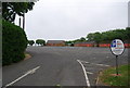
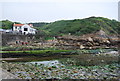
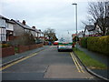
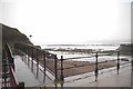
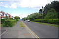
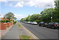
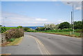
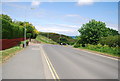
100 photos from this area
Area Information
Key information about the YO12 6RA including its size, population, and administrative classification.
- Area Type
- Postcode
- Area Size
- 1.7 hectares
- Population
- 2751
- Population Density
- 2877 people/km²
House Prices in YO12 6RA
40
Properties
£180,307
Average Sold Price
£52,000
Lowest Price
£400,000
Highest Price
Showing 40 properties
| Address | Type | Beds | Baths | Last Sale Price | Last Sale Date | |
|---|---|---|---|---|---|---|
| 132 Scholes Park Road, Scarborough, YO12 6RA | Detached | 4 | 2 | £400,000 | Jul 2025 | |
| 112 Scholes Park Road, Scarborough, YO12 6RA | house | 3 | - | £290,000 | Jul 2022 | |
| 115 Scholes Park Road, Scarborough, YO12 6RA | Retail | 3 | 1 | £255,000 | Jun 2022 | |
| 148 Scholes Park Road, Scarborough, YO12 6RA | Flat | - | - | £195,000 | Jun 2021 | |
| 146 Scholes Park Road, Scarborough, YO12 6RA | Flat | - | - | £160,000 | Jan 2021 | |
| 126 Scholes Park Road, Scarborough, YO12 6RA | Semi-detached | 3 | 1 | £185,000 | Sep 2018 | |
| 134 Scholes Park Road, Scarborough, YO12 6RA | Semi-detached | 3 | 1 | £263,000 | Mar 2018 | |
| 142 Scholes Park Road, Scarborough, YO12 6RA | Flat | - | - | £124,950 | Sep 2014 | |
| 124 Scholes Park Road, Scarborough, YO12 6RA | Semi-detached | 4 | - | £179,000 | Mar 2014 | |
| 106 Scholes Park Road, Scarborough, YO12 6RA | house | - | - | £182,500 | Oct 2012 |
Page 1 of 4
Energy Efficiency in YO12 6RA
Amenities
Schools
| Rank | School | Type | Entry gender | Ages |
|---|
Explore more schools in this area
Go to Schools tabDemographics
Household Size
Two person
most common
Accommodation Type
Houses
most common
Tenure
68
majority
Ethnic Group
White
most common
Religion
N/A
most common
Household Composition
N/A
most common
Age
47
median
Adults (30-64 years)
most common
Household Deprivation
N/A
with no deprivation
NS-SEC
28
in Lower managerial occupations
Explore more demographic insights in this area
Go to Demographics tabPlanning
Planning Constraints
- Flood RiskPremium
- Ramsar Wetland SitesPremium
- Area of Outstanding Natural BeautyPremium
- Protected Nature ReservePremium
- Protected WoodlandPremium