Area Overview for YO12 4PS
Photos of YO12 4PS
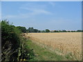

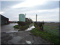
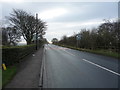
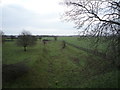

36 photos from this area
Area Information
Key information about the YO12 4PS including its size, population, and administrative classification.
- Area Type
- Postcode
- Area Size
- 13.5 hectares
- Population
- 1752
- Population Density
- 114 people/km²
House Prices in YO12 4PS
68
Properties
£136,533
Average Sold Price
£45,000
Lowest Price
£230,000
Highest Price
Showing 68 properties
| Address | Type | Beds | Baths | Last Sale Price | Last Sale Date | |
|---|---|---|---|---|---|---|
| 32A Main Street, Seamer, Scarborough, YO12 4PS | Cottage | 2 | 1 | £157,000 | Apr 2025 | |
| 26 Main Street, Seamer, Scarborough, YO12 4PS | Terraced | - | - | £125,000 | Apr 2025 | |
| 40 Main Street, Seamer, Scarborough, YO12 4PS | Terraced | 1 | - | £90,000 | Jul 2018 | |
| 17 Main Street, Seamer, Scarborough, YO12 4PS | Terraced | 3 | 1 | £230,000 | May 2016 | |
| 18 Main Street, Seamer, Scarborough, YO12 4PS | house | - | - | £110,000 | May 2012 | |
| 39 Main Street, Seamer, Scarborough, YO12 4PS | house | - | - | £225,000 | Jul 2010 | |
| 1, Londesborough Court, Main Street, Seamer, Scarborough, YO12 4PS | Detached | 4 | 2 | £186,000 | Sep 2009 | |
| 4, Londesborough Court, Main Street, Seamer, Scarborough, YO12 4PS | Detached | - | - | £185,000 | May 2009 | |
| 2, Londesborough Court, Main Street, Seamer, Scarborough, YO12 4PS | Detached | 4 | 2 | £225,000 | Jun 2008 | |
| Ash Lea, 34 Main Street, Seamer, Scarborough, YO12 4PS | Detached | 4 | 2 | £185,000 | Aug 2004 |
Page 1 of 7
Energy Efficiency in YO12 4PS
Amenities
Schools
| Rank | School | Type | Entry gender | Ages |
|---|
Explore more schools in this area
Go to Schools tabDemographics
Household Size
Two person
most common
Accommodation Type
Houses
most common
Tenure
86
majority
Ethnic Group
White
most common
Religion
N/A
most common
Household Composition
N/A
most common
Age
47
median
Adults (30-64 years)
most common
Household Deprivation
N/A
with no deprivation
NS-SEC
33
in Lower managerial occupations
Explore more demographic insights in this area
Go to Demographics tabPlanning
Planning Constraints
- Flood RiskPremium
- Ramsar Wetland SitesPremium
- Area of Outstanding Natural BeautyPremium
- Protected Nature ReservePremium
- Protected WoodlandPremium