Area Overview for YO11 3DR
Photos of YO11 3DR

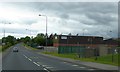
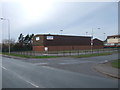
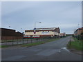
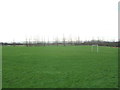
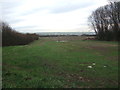
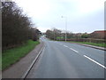
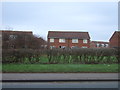
51 photos from this area
Area Information
Key information about the YO11 3DR including its size, population, and administrative classification.
- Area Type
- Postcode
- Area Size
- 1.9 hectares
- Population
- 1457
- Population Density
- 2969 people/km²
House Prices in YO11 3DR
38
Properties
£116,507
Average Sold Price
£20,790
Lowest Price
£172,000
Highest Price
Showing 38 properties
| Address | Type | Beds | Baths | Last Sale Price | Last Sale Date | |
|---|---|---|---|---|---|---|
| 60 Ryefield Road, Eastfield, Scarborough, YO11 3DR | house | 3 | 1 | £140,000 | Nov 2025 | |
| 54 Ryefield Road, Eastfield, Scarborough, YO11 3DR | Semi-detached | 3 | 1 | £172,000 | Apr 2024 | |
| 62 Ryefield Road, Eastfield, Scarborough, YO11 3DR | house | - | - | £160,000 | Apr 2023 | |
| 91 Ryefield Road, Eastfield, Scarborough, YO11 3DR | Terraced | 3 | 1 | £155,000 | Feb 2023 | |
| 38 Ryefield Road, Eastfield, Scarborough, YO11 3DR | house | - | - | £143,500 | Aug 2021 | |
| 87 Ryefield Road, Eastfield, Scarborough, YO11 3DR | house | - | - | £142,000 | Mar 2021 | |
| 83 Ryefield Road, Eastfield, Scarborough, YO11 3DR | Semi-detached | 3 | 1 | £132,500 | Feb 2019 | |
| 81 Ryefield Road, Eastfield, Scarborough, YO11 3DR | house | - | - | £121,950 | Oct 2017 | |
| 50 Ryefield Road, Eastfield, Scarborough, YO11 3DR | Semi-detached | - | - | £113,000 | Jun 2017 | |
| 34 Ryefield Road, Eastfield, Scarborough, YO11 3DR | Semi-detached | 4 | - | £111,000 | Jun 2017 |
Page 1 of 4
Energy Efficiency in YO11 3DR
Amenities
Schools
| Rank | School | Type | Entry gender | Ages |
|---|
Explore more schools in this area
Go to Schools tabDemographics
Household Size
One person
most common
Accommodation Type
Houses
most common
Tenure
40
majority
Ethnic Group
White
most common
Religion
N/A
most common
Household Composition
N/A
most common
Age
47
median
Adults (30-64 years)
most common
Household Deprivation
N/A
with no deprivation
NS-SEC
15
in Lower managerial occupations
Explore more demographic insights in this area
Go to Demographics tabPlanning
Planning Constraints
- Flood RiskPremium
- Ramsar Wetland SitesPremium
- Area of Outstanding Natural BeautyPremium
- Protected Nature ReservePremium
- Protected WoodlandPremium