Area Overview for YO11 1RU
Photos of YO11 1RU
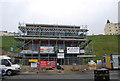
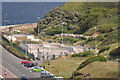
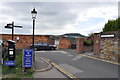
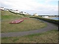
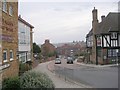
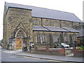
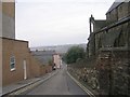
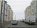
100 photos from this area
Area Information
Key information about the YO11 1RU including its size, population, and administrative classification.
- Area Type
- Postcode
- Area Size
- 1858 m²
- Population
- 1271
- Population Density
- 2703 people/km²
House Prices in YO11 1RU
17
Properties
£266,222
Average Sold Price
£74,000
Lowest Price
£385,000
Highest Price
Showing 17 properties
| Address | Type | Beds | Baths | Last Sale Price | Last Sale Date | |
|---|---|---|---|---|---|---|
| 6, Graham Close, Paradise, Scarborough, YO11 1RU | Terraced | 3 | 2 | £385,000 | Jul 2025 | |
| 6 Graham Close, Scarborough, YO11 1RU | Terraced | 3 | 1 | £385,000 | Jul 2025 | |
| 5, Graham Close, Paradise, Scarborough, YO11 1RU | Retail | 4 | 2 | £375,000 | Jul 2022 | |
| 4, Graham Close, Paradise, Scarborough, YO11 1RU | house | - | - | £310,000 | Mar 2022 | |
| 3, Graham Close, Paradise, Scarborough, YO11 1RU | house | 3 | 1 | £340,000 | Sep 2021 | |
| 8, Graham Close, Paradise, Scarborough, YO11 1RU | Terraced | 4 | 2 | £300,000 | Apr 2008 | |
| 7, Graham Close, Paradise, Scarborough, YO11 1RU | Terraced | - | - | £125,000 | Jun 2001 | |
| 2, Graham Close, Paradise, Scarborough, YO11 1RU | Terraced | - | - | £102,000 | Nov 1998 | |
| 1, Graham Close, Paradise, Scarborough, YO11 1RU | Bungalow | 2 | 1 | £74,000 | Oct 1995 | |
| 8 Graham Close, Scarborough, YO11 1RU | undefined | - | - | - | - |
Page 1 of 2
Energy Efficiency in YO11 1RU
Amenities
Schools
| Rank | School | Type | Entry gender | Ages |
|---|
Explore more schools in this area
Go to Schools tabDemographics
Household Size
One person
most common
Accommodation Type
Flats
most common
Tenure
43
majority
Ethnic Group
White
most common
Religion
N/A
most common
Household Composition
N/A
most common
Age
47
median
Adults (30-64 years)
most common
Household Deprivation
N/A
with no deprivation
NS-SEC
25
in Lower managerial occupations
Explore more demographic insights in this area
Go to Demographics tabPlanning
Planning Constraints
- Flood RiskPremium
- Ramsar Wetland SitesPremium
- Area of Outstanding Natural BeautyPremium
- Protected Nature ReservePremium
- Protected WoodlandPremium