Area Overview for YO11 1BW
Photos of YO11 1BW
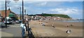
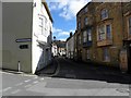
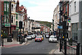
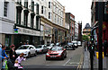
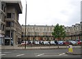
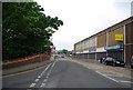
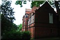
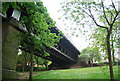
100 photos from this area
Area Information
Key information about the YO11 1BW including its size, population, and administrative classification.
- Area Type
- Postcode
- Area Size
- 1339 m²
- Population
- 1670
- Population Density
- 6282 people/km²
House Prices in YO11 1BW
11
Properties
£106,750
Average Sold Price
£74,000
Lowest Price
£135,000
Highest Price
Showing 11 properties
| Address | Type | Beds | Baths | Last Sale Price | Last Sale Date | |
|---|---|---|---|---|---|---|
| 8 Swan Hill Road, Scarborough, YO11 1BW | house | 3 | 1 | £129,999 | Dec 2024 | |
| 5 Swan Hill Road, Scarborough, YO11 1BW | house | - | - | £135,000 | Dec 2021 | |
| 9 Swan Hill Road, Scarborough, YO11 1BW | Terraced | 3 | 1 | £74,000 | Feb 2016 | |
| 10 Swan Hill Road, Scarborough, YO11 1BW | Terraced | 3 | 1 | £88,000 | Aug 2015 | |
| 6 Swan Hill Road, Scarborough, YO11 1BW | undefined | - | - | - | - | |
| Swanhill Workshop, Swan Hill Road, Scarborough, YO11 1BW | undefined | - | - | - | - | |
| 7 Swan Hill Road, Scarborough, YO11 1BW | house | - | - | - | - | |
| Flat 3, Chapel House, Swan Hill Road, Scarborough, YO11 1BW | Flat | - | - | - | - | |
| Woods, Swan Hill Road, Scarborough, YO11 1BW | undefined | - | - | - | - | |
| Caravan Outside Timeless Fireplaces, Swan Hill Road, Scarborough, YO11 1BW | Mobile Home | - | - | - | - |
Page 1 of 2
Energy Efficiency in YO11 1BW
Amenities
Schools
| Rank | School | Type | Entry gender | Ages |
|---|
Explore more schools in this area
Go to Schools tabDemographics
Household Size
One person
most common
Accommodation Type
Flats
most common
Tenure
18
majority
Ethnic Group
White
most common
Religion
N/A
most common
Household Composition
N/A
most common
Age
47
median
Adults (30-64 years)
most common
Household Deprivation
N/A
with no deprivation
NS-SEC
13
in Lower managerial occupations
Explore more demographic insights in this area
Go to Demographics tabPlanning
Planning Constraints
- Flood RiskPremium
- Ramsar Wetland SitesPremium
- Area of Outstanding Natural BeautyPremium
- Protected Nature ReservePremium
- Protected WoodlandPremium