Area Overview for YO10 5EF
Photos of YO10 5EF
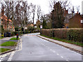
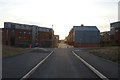


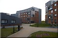
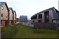
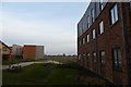

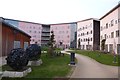

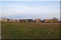
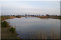
100 photos from this area
Area Information
Key information about the YO10 5EF including its size, population, and administrative classification.
- Area Type
- Postcode
- Area Size
- 3.8 hectares
- Population
- 6219
- Population Density
- 490 people/km²
House Prices in YO10 5EF
35
Properties
£283,067
Average Sold Price
£66,000
Lowest Price
£415,000
Highest Price
Showing 35 properties
| Address | Type | Beds | Baths | Last Sale Price | Last Sale Date | |
|---|---|---|---|---|---|---|
| 4 The Crescent, Heslington, York, YO10 5EF | Semi-detached | 3 | 2 | £405,000 | May 2024 | |
| 21 The Crescent, Heslington, York, YO10 5EF | Semi-detached | 3 | 2 | £412,500 | Feb 2024 | |
| 32 The Crescent, Heslington, York, YO10 5EF | house | 6 | 6 | £350,000 | Apr 2023 | |
| 28 The Crescent, Heslington, York, YO10 5EF | Semi-detached | 3 | 1 | £385,000 | Mar 2023 | |
| 11 The Crescent, Heslington, York, YO10 5EF | Semi-detached | 3 | 2 | £415,000 | Nov 2022 | |
| 1 The Crescent, Heslington, York, YO10 5EF | Semi-detached | 3 | 1 | £323,000 | Jan 2020 | |
| 8 The Crescent, Heslington, York, YO10 5EF | house | - | - | £295,000 | May 2019 | |
| 22 The Crescent, Heslington, York, YO10 5EF | house | - | - | £265,000 | Feb 2019 | |
| 13 The Crescent, Heslington, York, YO10 5EF | house | - | - | £230,000 | Nov 2012 | |
| 17 The Crescent, Heslington, York, YO10 5EF | house | 3 | - | £208,000 | Jul 2010 |
Page 1 of 4
Energy Efficiency in YO10 5EF
Amenities
Schools
| Rank | School | Type | Entry gender | Ages |
|---|
Explore more schools in this area
Go to Schools tabDemographics
Household Size
One person
most common
Accommodation Type
Houses
most common
Tenure
57
majority
Ethnic Group
White
most common
Religion
N/A
most common
Household Composition
N/A
most common
Age
22
median
Young Adults (15-29 years)
most common
Household Deprivation
N/A
with no deprivation
NS-SEC
6
in Lower managerial occupations
Explore more demographic insights in this area
Go to Demographics tabPlanning
Planning Constraints
- Flood RiskPremium
- Ramsar Wetland SitesPremium
- Area of Outstanding Natural BeautyPremium
- Protected Nature ReservePremium
- Protected WoodlandPremium