Area Overview for YO10 4QB
Photos of YO10 4QB
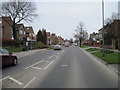
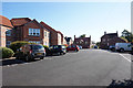
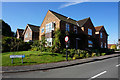
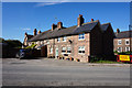
100 photos from this area
Area Information
Key information about the YO10 4QB including its size, population, and administrative classification.
- Area Type
- Postcode
- Area Size
- 3423 m²
- Population
- 1386
- Population Density
- 262 people/km²
House Prices in YO10 4QB
8
Properties
£211,463
Average Sold Price
£92,000
Lowest Price
£310,000
Highest Price
Showing 8 properties
| Address | Type | Beds | Baths | Last Sale Price | Last Sale Date | |
|---|---|---|---|---|---|---|
| 2 Fulford Mews, York, YO10 4QB | Bungalow | 2 | 1 | £275,000 | Jan 2024 | |
| 1 Fulford Mews, York, YO10 4QB | Bungalow | 2 | 1 | £310,000 | May 2022 | |
| 7 Fulford Mews, York, YO10 4QB | Semi-detached | 2 | 1 | £285,250 | Sep 2021 | |
| 5B Fulford Mews, York, YO10 4QB | Flat | - | - | £152,000 | Dec 2018 | |
| 5A Fulford Mews, York, YO10 4QB | Flat | - | - | £162,500 | Dec 2014 | |
| 4 Fulford Mews, York, YO10 4QB | Terraced | 2 | 2 | £225,000 | Dec 2012 | |
| 3 Fulford Mews, York, YO10 4QB | Terraced | - | - | £189,950 | Jul 2002 | |
| 6 Fulford Mews, York, YO10 4QB | Bungalow | 2 | 2 | £92,000 | Feb 1999 |
Energy Efficiency in YO10 4QB
Amenities
Schools
| Rank | School | Type | Entry gender | Ages |
|---|
Explore more schools in this area
Go to Schools tabDemographics
Household Size
Two person
most common
Accommodation Type
Houses
most common
Tenure
57
majority
Ethnic Group
White
most common
Religion
N/A
most common
Household Composition
N/A
most common
Age
47
median
Adults (30-64 years)
most common
Household Deprivation
N/A
with no deprivation
NS-SEC
42
in Lower managerial occupations
Explore more demographic insights in this area
Go to Demographics tabPlanning
Planning Constraints
- Flood RiskPremium
- Ramsar Wetland SitesPremium
- Area of Outstanding Natural BeautyPremium
- Protected Nature ReservePremium
- Protected WoodlandPremium