Area Overview for YO10 4PN
Photos of YO10 4PN

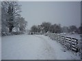
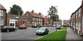

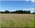
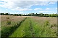
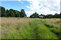
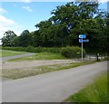

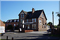
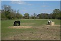
100 photos from this area
Area Information
Key information about the YO10 4PN including its size, population, and administrative classification.
- Area Type
- Postcode
- Area Size
- 1.5 hectares
- Population
- 1386
- Population Density
- 262 people/km²
House Prices in YO10 4PN
41
Properties
£319,429
Average Sold Price
£42,000
Lowest Price
£831,900
Highest Price
Showing 41 properties
| Address | Type | Beds | Baths | Last Sale Price | Last Sale Date | |
|---|---|---|---|---|---|---|
| 103 Main Street, Fulford, York, YO10 4PN | Terraced | 2 | 1 | £250,000 | Dec 2025 | |
| 3, Dairy Farm Court, Main Street, Fulford, York, YO10 4PN | Flat | 2 | 1 | £170,000 | Sep 2025 | |
| Rose Cottage, 61 Main Street, Fulford, York, YO10 4PN | Semi-detached | 2 | 1 | £445,000 | Jun 2025 | |
| 2, Dairy Farm Court, Main Street, Fulford, York, YO10 4PN | Flat | 2 | 1 | £165,000 | Sep 2024 | |
| 79 Main Street, Fulford, York, YO10 4PN | Terraced | 4 | 2 | £640,000 | Jul 2024 | |
| Pickle Cottage, 97 Main Street, Fulford, York, YO10 4PN | Terraced | 2 | 1 | £280,308 | Feb 2024 | |
| 91 Main Street, Fulford, York, YO10 4PN | house | - | - | £711,500 | Nov 2023 | |
| Private Accommodation, Bay Horse Public House, 105 Main Street, Fulford, York, YO10 4PN | Flat | - | - | £831,900 | Apr 2023 | |
| 93 Main Street, Fulford, York, YO10 4PN | house | 3 | - | £470,000 | Nov 2021 | |
| 53 Main Street, Fulford, York, YO10 4PN | house | 1 | - | £385,000 | Feb 2021 |
Page 1 of 5
Energy Efficiency in YO10 4PN
Amenities
Schools
| Rank | School | Type | Entry gender | Ages |
|---|
Explore more schools in this area
Go to Schools tabDemographics
Household Size
Two person
most common
Accommodation Type
Houses
most common
Tenure
57
majority
Ethnic Group
White
most common
Religion
N/A
most common
Household Composition
N/A
most common
Age
47
median
Adults (30-64 years)
most common
Household Deprivation
N/A
with no deprivation
NS-SEC
42
in Lower managerial occupations
Explore more demographic insights in this area
Go to Demographics tabPlanning
Planning Constraints
- Flood RiskPremium
- Ramsar Wetland SitesPremium
- Area of Outstanding Natural BeautyPremium
- Protected Nature ReservePremium
- Protected WoodlandPremium