Area Overview for YO10 4NG
Photos of YO10 4NG
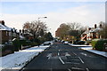
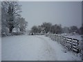
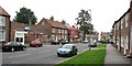
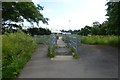
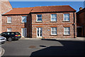
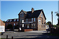
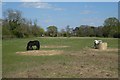
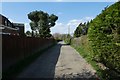
100 photos from this area
Area Information
Key information about the YO10 4NG including its size, population, and administrative classification.
- Area Type
- Postcode
- Area Size
- 3.3 hectares
- Population
- 1698
- Population Density
- 1798 people/km²
House Prices in YO10 4NG
32
Properties
£228,731
Average Sold Price
£59,995
Lowest Price
£424,000
Highest Price
Showing 32 properties
| Address | Type | Beds | Baths | Last Sale Price | Last Sale Date | |
|---|---|---|---|---|---|---|
| 22 Tilmire Close, York, YO10 4NG | Semi-detached | 3 | 2 | £390,000 | Aug 2023 | |
| 5 Tilmire Close, York, YO10 4NG | Bungalow | 3 | 2 | £253,000 | Jan 2023 | |
| 8 Tilmire Close, York, YO10 4NG | Semi-detached | 3 | 1 | £350,000 | Sep 2022 | |
| 28 Tilmire Close, York, YO10 4NG | house | - | - | £325,000 | Sep 2021 | |
| 11 Tilmire Close, York, YO10 4NG | house | - | - | £424,000 | Jul 2021 | |
| 2 Tilmire Close, York, YO10 4NG | Bungalow | - | - | £227,000 | Aug 2020 | |
| 18 Tilmire Close, York, YO10 4NG | Semi-detached | 4 | 2 | £307,500 | Feb 2020 | |
| 32 Tilmire Close, York, YO10 4NG | Semi-detached | 3 | 1 | £267,500 | Jul 2019 | |
| 6 Tilmire Close, York, YO10 4NG | Bungalow | 4 | 1 | £252,500 | Feb 2019 | |
| 14 Tilmire Close, York, YO10 4NG | Semi-detached | 4 | 2 | £295,000 | Nov 2018 |
Page 1 of 4
Energy Efficiency in YO10 4NG
Amenities
Schools
| Rank | School | Type | Entry gender | Ages |
|---|
Explore more schools in this area
Go to Schools tabDemographics
Household Size
Family (3-5 people)
most common
Accommodation Type
Houses
most common
Tenure
83
majority
Ethnic Group
White
most common
Religion
N/A
most common
Household Composition
N/A
most common
Age
47
median
Adults (30-64 years)
most common
Household Deprivation
N/A
with no deprivation
NS-SEC
41
in Lower managerial occupations
Explore more demographic insights in this area
Go to Demographics tabPlanning
Planning Constraints
- Flood RiskPremium
- Ramsar Wetland SitesPremium
- Area of Outstanding Natural BeautyPremium
- Protected Nature ReservePremium
- Protected WoodlandPremium