Area Overview for YO10 4BH
Photos of YO10 4BH
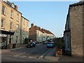
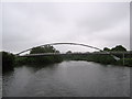
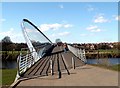


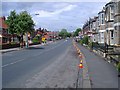
100 photos from this area
Area Information
Key information about the YO10 4BH including its size, population, and administrative classification.
- Area Type
- Postcode
- Area Size
- 5037 m²
- Population
- 1870
- Population Density
- 5851 people/km²
House Prices in YO10 4BH
25
Properties
£324,191
Average Sold Price
£84,950
Lowest Price
£725,000
Highest Price
Showing 25 properties
| Address | Type | Beds | Baths | Last Sale Price | Last Sale Date | |
|---|---|---|---|---|---|---|
| 9 Grange Street, York, YO10 4BH | Terraced | 4 | 2 | £725,000 | Jul 2024 | |
| 10 Grange Street, York, YO10 4BH | Terraced | 3 | 1 | £480,000 | Jun 2022 | |
| 8 Grange Street, York, YO10 4BH | Terraced | 2 | 1 | £370,000 | Feb 2022 | |
| 24 Grange Street, York, YO10 4BH | house | - | - | £438,000 | Sep 2021 | |
| 26 Grange Street, York, YO10 4BH | Detached | 4 | 2 | £520,000 | Dec 2019 | |
| 1 Grange Street, York, YO10 4BH | Flat | 1 | 1 | £526,000 | Feb 2019 | |
| 18 Grange Street, York, YO10 4BH | house | - | - | £380,000 | Sep 2018 | |
| 7 Grange Street, York, YO10 4BH | house | 4 | 2 | £330,000 | Mar 2014 | |
| 5 Grange Street, York, YO10 4BH | house | - | - | £287,000 | Jun 2010 | |
| 6 Grange Street, York, YO10 4BH | house | - | - | £155,000 | Sep 2009 |
Page 1 of 3
Energy Efficiency in YO10 4BH
Amenities
Schools
| Rank | School | Type | Entry gender | Ages |
|---|
Explore more schools in this area
Go to Schools tabDemographics
Household Size
One person
most common
Accommodation Type
Houses
most common
Tenure
33
majority
Ethnic Group
White
most common
Religion
N/A
most common
Household Composition
N/A
most common
Age
22
median
Young Adults (15-29 years)
most common
Household Deprivation
N/A
with no deprivation
NS-SEC
25
in Lower managerial occupations
Explore more demographic insights in this area
Go to Demographics tabPlanning
Planning Constraints
- Flood RiskPremium
- Ramsar Wetland SitesPremium
- Area of Outstanding Natural BeautyPremium
- Protected Nature ReservePremium
- Protected WoodlandPremium