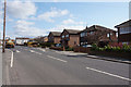
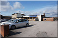
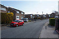
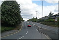
Area Overview for Wrenthorpe and Outwood West Ward
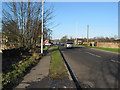
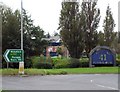
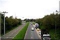
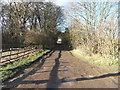
Photos of Wrenthorpe and Outwood West Ward
Area Information
Wrenthorpe and Outwood West Ward sits within the district of the Borough of Wakefield in South Yorkshire, England. This specific ward covers an area of 10.8 square kilometres. A total of 6,391 residents call this district home. That equates to a population density of 590 people per square kilometre. The area is defined by its moderately high density settlement pattern. Living in Wrenthorpe and Outwood West Ward offers a balance between residential habitation and available local space. The population figure suggests a steady community size without the congestion typical of larger urban centres. Residents here benefit from a compact neighbourhood structure where services are relatively accessible. The ward provides a contained living environment focused on community cohesion rather than sprawling expansion. You will find that daily life revolves around local interactions and established routines within this defined boundary. The physical size of the ward means that travel distances to key amenities are generally short compared to larger rural districts. ### The community profile of Wrenthorpe and Outwood West Ward is heavily weighted towards older residents. The median age for people living in this ward stands at 70 years old. This central tendency indicates that the population is predominantly made up of seniors and retirees. Most common age ranges align with this high median figure, creating a quiet, mature demographic. A significant 75 per cent of households in Wrenthorpe and Outwood West Ward own their homes outright or with a mortgage. This high rate of home ownership shapes the local economy and community stability. There is a very strong preference for independent living arrangements among the population. Accommodation types tend to reflect this need for space and stability, often accommodating age-related requirements. The social fabric is built around this settled population rather than younger families moving frequently. You are likely to meet long-term residents who have called this home for decades. This demographic concentration influences local shop offerings and service availability to suit an older clientele. ### The housing market in Wrenthorpe and Outwood West Ward is overwhelmingly characterised by person ownership rather than tenancy. With 75 per cent of the population owning their homes, rental properties are a small minority of the stock. Living in Wrenthorhe and Outwood West Ward mostly means dealing with buy-to-let investments or second homes that are actively used. The high home ownership rate suggests that the land and property values have remained stable over time for these established residents. Schools near Wrenthorpe and Outwood West Ward are likely to cater to older families or remain closed depending on demographic shifts, though specific school names are not recorded in available data. The accommodation type distribution reflects this stability, with fewer purpose-built rentals for younger workers entering the market. Buyers looking for homes in Wrenthorpe and Outwood West Ward should expect to find a wide selection of properties available on the open market. The market is not driven by transient trends but by the needs of the existing owner-occupier base. Understanding this structure helps you evaluate the potential for capital growth or the necessity of renting locally. ### Digital infrastructure serves as the primary method of transportation for information and commerce in Wrenthorpe and Outwood West Ward. The fixed broadband quality score for the area reaches 99 out of 100. This excellent rating ensures reliable high-speed internet access for every household. Living in Wrenthorpe and Outwood West Ward offers connectivity that supports robust remote working arrangements and streaming activities. You can download large files or attend video conferences without interruption. The mobile network scores complement this digital foundation, providing seamless coverage for navigation while driving to local amenities. The combination of top-tier broadband and mobile service means physical transport constraints matter less for daily tasks. Homes in Wrenthorpe and Outwood West Ward act as fully connected digital hubs. For residents who rely on frequent internet usage, this technical setup removes a major barrier to entry. The area functions effectively as a self-sufficient node where digital transport facilitates local business and personal communication. ### Environmental and safety assessments reveal a mixed picture for residents of Wrenthorpe and Outwood West Ward. The ward passes flood risk checks with a low score of 1.82, indicating minimal threat from water accumulation during heavy rain. There are no Ramsar wetland sites, Areas of Outstanding Natural Beauty, protected nature reserves, or protected woodland within the ward boundaries. This lack of planning constraints simplifies potential local construction or development projects compared to sensitive conservation areas. However, the crime risk assessment presents a more significant consideration for those choosing to live here. The crime risk level is flagged as a warning with a score of 63 out of 100. This medium crime risk suggests that incidents occur at rates around the national average. You should expect to apply standard security precautions when securing your property. Standard advice such as robust door locks and neighbourhood watch participation remains necessary. While the environmental hazards are virtually non-existent, vigilance regarding personal safety is a practical requirement for anyone settling permanently in this district. ### Who is the typical demographic of the people living in Wrenthorpe and Outwood West Ward?The community in this ward is notably older. The median age for residents reaches 70 years, indicating a population dominated by seniors and retirees. With 75 per cent of households owning their homes, the area serves as a retirement hub rather than a young family centre. How safe is Wrenthorpe and Outwood West Ward for families or individuals?The environmental safety is high, with a low flood risk score of 1.82 and no protected nature reserves. However, the crime risk carries a warning status with a score of 63. This medium risk means crime rates are average, requiring standard security precautions like good doors and lighting. Will the internet connection allow me to work from home effectively here?Digital connectivity is excellent for remote working. The fixed broadband quality score is 99 out of 100, guaranteeing high-speed access. Combined with strong mobile coverage, you can handle video calls and large file transfers without interruption while living in the ward. Are there any restrictions on building or developing land within the ward?There are no major planning constraints in Wrenthorpe and Outwood West Ward. The area contains no Ramsar sites, Areas of Outstanding Natural Beauty, protected woodlands, or nature reserves. This allows for straightforward land management compared to environmentally sensitive zones, as confirmed by the zero scores for these categories.
- Area Type
- District Borough Unitary Ward
- Area Size
- 10.8 km²
- Population
- 6391
- Population Density
- 590 people/km²
Demographics
The community profile of Wrenthorpe and Outwood West Ward is heavily weighted towards older residents. The median age for people living in this ward stands at 70 years old. This central tendency indicates that the population is predominantly made up of seniors and retirees. Most common age ranges align with this high median figure, creating a quiet, mature demographic. A significant 75 per cent of households in Wrenthorpe and Outwood West Ward own their homes outright or with a mortgage. This high rate of home ownership shapes the local economy and community stability. There is a very strong preference for independent living arrangements among the population. Accommodation types tend to reflect this need for space and stability, often accommodating age-related requirements. The social fabric is built around this settled population rather than younger families moving frequently. You are likely to meet long-term residents who have called this home for decades. This demographic concentration influences local shop offerings and service availability to suit an older clientele. ### The housing market in Wrenthorpe and Outwood West Ward is overwhelmingly characterised by person ownership rather than tenancy. With 75 per cent of the population owning their homes, rental properties are a small minority of the stock. Living in Wrenthorhe and Outwood West Ward mostly means dealing with buy-to-let investments or second homes that are actively used. The high home ownership rate suggests that the land and property values have remained stable over time for these established residents. Schools near Wrenthorpe and Outwood West Ward are likely to cater to older families or remain closed depending on demographic shifts, though specific school names are not recorded in available data. The accommodation type distribution reflects this stability, with fewer purpose-built rentals for younger workers entering the market. Buyers looking for homes in Wrenthorpe and Outwood West Ward should expect to find a wide selection of properties available on the open market. The market is not driven by transient trends but by the needs of the existing owner-occupier base. Understanding this structure helps you evaluate the potential for capital growth or the necessity of renting locally. ### Digital infrastructure serves as the primary method of transportation for information and commerce in Wrenthorpe and Outwood West Ward. The fixed broadband quality score for the area reaches 99 out of 100. This excellent rating ensures reliable high-speed internet access for every household. Living in Wrenthorpe and Outwood West Ward offers connectivity that supports robust remote working arrangements and streaming activities. You can download large files or attend video conferences without interruption. The mobile network scores complement this digital foundation, providing seamless coverage for navigation while driving to local amenities. The combination of top-tier broadband and mobile service means physical transport constraints matter less for daily tasks. Homes in Wrenthorpe and Outwood West Ward act as fully connected digital hubs. For residents who rely on frequent internet usage, this technical setup removes a major barrier to entry. The area functions effectively as a self-sufficient node where digital transport facilitates local business and personal communication. ### Environmental and safety assessments reveal a mixed picture for residents of Wrenthorpe and Outwood West Ward. The ward passes flood risk checks with a low score of 1.82, indicating minimal threat from water accumulation during heavy rain. There are no Ramsar wetland sites, Areas of Outstanding Natural Beauty, protected nature reserves, or protected woodland within the ward boundaries. This lack of planning constraints simplifies potential local construction or development projects compared to sensitive conservation areas. However, the crime risk assessment presents a more significant consideration for those choosing to live here. The crime risk level is flagged as a warning with a score of 63 out of 100. This medium crime risk suggests that incidents occur at rates around the national average. You should expect to apply standard security precautions when securing your property. Standard advice such as robust door locks and neighbourhood watch participation remains necessary. While the environmental hazards are virtually non-existent, vigilance regarding personal safety is a practical requirement for anyone settling permanently in this district. ### Who is the typical demographic of the people living in Wrenthorpe and Outwood West Ward?The community in this ward is notably older. The median age for residents reaches 70 years, indicating a population dominated by seniors and retirees. With 75 per cent of households owning their homes, the area serves as a retirement hub rather than a young family centre. How safe is Wrenthorpe and Outwood West Ward for families or individuals?The environmental safety is high, with a low flood risk score of 1.82 and no protected nature reserves. However, the crime risk carries a warning status with a score of 63. This medium risk means crime rates are average, requiring standard security precautions like good doors and lighting. Will the internet connection allow me to work from home effectively here?Digital connectivity is excellent for remote working. The fixed broadband quality score is 99 out of 100, guaranteeing high-speed access. Combined with strong mobile coverage, you can handle video calls and large file transfers without interruption while living in the ward. Are there any restrictions on building or developing land within the ward?There are no major planning constraints in Wrenthorpe and Outwood West Ward. The area contains no Ramsar sites, Areas of Outstanding Natural Beauty, protected woodlands, or nature reserves. This allows for straightforward land management compared to environmentally sensitive zones, as confirmed by the zero scores for these categories.
Household Size
Accommodation Type
Tenure
Ethnic Group
Religion
Household Composition
Age
Household Deprivation
NS-SEC
Explore more demographic insights in this area
Go to Demographics tabPlanning
Planning Constraints
- Flood RiskPremium
- Ramsar Wetland SitesPremium
- Area of Outstanding Natural BeautyPremium
- Protected Nature ReservePremium
- Protected WoodlandPremium
- Crime RiskPremium