Area Overview for Whitley (North Yorkshire)
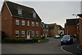
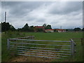
Photos of Whitley (North Yorkshire)


Area Information
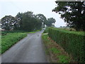
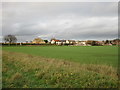
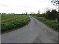
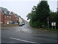
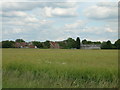
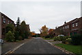
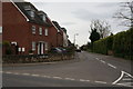
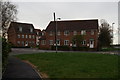
Whitley in North Yorkshire is a compact built-up area spanning 29.3 hectares, offering a quiet, established living environment. The area’s median age of 70 suggests a community rooted in stability, with a high proportion of home ownership—83% of residents own their properties. This reflects a long-standing local presence rather than transient populations. Daily life here is shaped by practical accessibility: four nearby railway stations, including Whitley Bridge and Hensall, provide regular connections to surrounding towns, while five retail outlets, such as Sainsburys Racca and Aldi Selby Road, cater to everyday needs. The area’s broadband score of 100 ensures seamless digital connectivity, supporting both work and leisure. While Whitley lacks the vibrancy of larger cities, its simplicity and functional infrastructure make it appealing to those prioritising convenience over urban amenities. For buyers seeking a low-maintenance, owner-occupied lifestyle with reliable transport links, Whitley offers a straightforward, if unassuming, alternative to more densely populated regions.
- Area Type
- Built Up Area 250
- Area Size
- 29.3 hectares
- Population
- Not available
- Population Density
- Not available
Whitley’s lifestyle is defined by its practical amenities and accessible transport. Within walking or short driving distance, residents have access to five retail outlets, including Sainsburys Racca and Aldi Selby Road, ensuring everyday shopping needs are met. Four railway stations—such as Hensall and Knottingley—provide regular connections to nearby towns, facilitating both work and leisure trips. While the area lacks large parks or cultural landmarks, its compact size means amenities are tightly clustered, reducing travel time. The absence of detailed data on dining or leisure options means the area’s social scene remains underexplored, but the presence of multiple retail stores suggests a modest yet functional community. For those valuing convenience over expansive recreational facilities, Whitley offers a straightforward, if unadorned, lifestyle with reliable access to essentials.
Amenities
Schools
| Rank | A + A* % | School | Type | Entry gender | Ages |
|---|
Explore more schools in this area
Go to Schools tabDemographics
Whitley’s population is predominantly older, with a median age of 70, indicating a community where retirement or long-term settlement is common. Home ownership is exceptionally high at 83%, suggesting a stable, long-term resident base with minimal rental activity. The area’s demographic data does not specify household composition or ethnic diversity, but the overall figures imply a cohesive, possibly homogenous population. The absence of detailed breakdowns on accommodation types or deprivation levels means the area’s socio-economic profile remains largely undefined beyond these figures. For residents, this translates to a predictable, low-turnover environment where property values may be influenced more by age-related factors than by fluctuating market trends. The high home ownership rate also suggests that most residents are not reliant on rental income, which may affect local economic dynamics.
Household Size
Accommodation Type
Tenure
Ethnic Group
Religion
Household Composition
Age
Household Deprivation
NS-SEC
Explore more demographic insights in this area
Go to Demographics tabPlanning
Planning Constraints
- Crime RiskLocked