Area Overview for Whitby
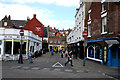
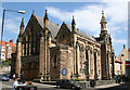
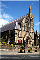
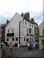
Photos of Whitby


Area Information
Living in Whitby offers a distinct blend of compact community life and accessible amenities within a small but well-defined area. Covering 4.1 km², the town is home to 1,306 residents, giving it a population density of 322 people per square kilometre. This density suggests a tightly knit neighbourhood where daily life is shaped by proximity to essential services. Whitby’s character is influenced by its age profile, with a median age of 70, indicating a community skewed toward older residents. The area’s charm lies in its practicality: nearby rail stations, including Whitby and Ruswarp, provide easy access to regional travel, while local shops like Co-op Whitby and Heron Whitby cater to everyday needs. Despite its small size, Whitby balances simplicity with convenience, offering a quiet lifestyle without sacrificing connectivity. For those seeking a low-maintenance, community-focused environment, this area provides a foundation of stability, though its demographic profile suggests a more mature population.
- Area Type
- Built Up Area 250
- Area Size
- 4.1 km²
- Population
- 1306
- Population Density
- 322 people/km²
Whitby’s lifestyle is defined by its proximity to essential amenities, including four rail stations and five local shops. Retail options like Co-op Whitby and Heron Whitby provide convenience for daily shopping, while rail access to Whitby and Sleights stations offers regional connectivity. The area’s compact size means amenities are within practical reach, though the lack of detailed data on parks or leisure facilities limits insight into recreational options. The presence of multiple primary schools and local shops suggests a focus on community living, with a balance between simplicity and accessibility. For residents, this translates to a low-maintenance lifestyle, where essentials are nearby but the area’s character remains subdued. The absence of specific data on dining or leisure venues means potential for further exploration, though the existing infrastructure supports a functional, everyday existence.
Amenities
Schools
Whitby is served by five primary schools, including Whitby, East Whitby Community Primary School, Airy Hill Community Primary School, West Cliff Primary School, and Stakesby Community Primary School. Ruswarp Church of England Voluntary Controlled Primary School holds an Ofsted rating of satisfactory, offering a baseline standard for local education. The concentration of primary schools suggests a focus on early education, though secondary school options are not listed in the data. For families, this mix provides multiple choices for younger children but may require travel for older students. The presence of five primary schools within practical reach indicates a commitment to local education, though the absence of detailed performance metrics means outcomes remain unquantified. Parents should consider proximity to secondary schools when evaluating long-term educational needs.
| Rank | School | Type | Entry gender | Ages |
|---|
Explore more schools in this area
Go to Schools tabDemographics
Whitby’s population is defined by its median age of 70, the highest in the dataset, which suggests a community predominantly composed of older adults. The most common age range is listed as “Total,” reflecting a lack of detailed breakdowns, but the high median age implies limited presence of younger families. Home ownership stands at 65%, indicating a majority of residents live in their own homes rather than renting. Accommodation types and household composition data are not specified, but the population density of 322 people per km² suggests a mix of terraced housing and compact dwellings. The absence of detailed diversity or deprivation data means broader socioeconomic factors remain unclear. However, the high median age may influence local dynamics, such as healthcare needs or community engagement patterns. For buyers, this profile highlights a stable, mature demographic but may not align with those seeking a rapidly growing or family-oriented environment.
Household Size
Accommodation Type
Tenure
Ethnic Group
Religion
Household Composition
Age
Household Deprivation
NS-SEC
Explore more demographic insights in this area
Go to Demographics tabPlanning
Planning Constraints
- Crime RiskPremium