Area Overview for WF9 3DN
Photos of WF9 3DN
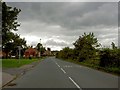
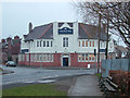
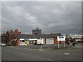
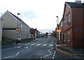
19 photos from this area
Area Information
Key information about the WF9 3DN including its size, population, and administrative classification.
- Area Type
- Postcode
- Area Size
- 2.2 hectares
- Population
- 1561
- Population Density
- 3826 people/km²
House Prices in WF9 3DN
29
Properties
£136,188
Average Sold Price
£41,500
Lowest Price
£250,000
Highest Price
Showing 29 properties
| Address | Type | Beds | Baths | Last Sale Price | Last Sale Date | |
|---|---|---|---|---|---|---|
| Wendaholme, Radford Park Avenue, South Kirkby, Pontefract, WF9 3DN | house | - | - | £170,000 | Nov 2025 | |
| 26 Radford Park Avenue, South Kirkby, Pontefract, WF9 3DN | Detached | 3 | 1 | £235,000 | Jul 2024 | |
| 19 Radford Park Avenue, South Kirkby, Pontefract, WF9 3DN | Bungalow | 2 | 1 | £176,000 | Dec 2023 | |
| Clonmore, Radford Park Avenue, South Kirkby, Pontefract, WF9 3DN | house | 4 | 2 | £250,000 | Sep 2023 | |
| Oakwell, Radford Park Avenue, South Kirkby, Pontefract, WF9 3DN | house | - | - | £160,000 | Sep 2022 | |
| 36 Radford Park Avenue, South Kirkby, Pontefract, WF9 3DN | Detached | 3 | 1 | £178,000 | Dec 2019 | |
| Wyndrift, Radford Park Avenue, South Kirkby, Pontefract, WF9 3DN | Semi-detached | 3 | 1 | £147,000 | Mar 2019 | |
| 5 Radford Park Avenue, South Kirkby, Pontefract, WF9 3DN | Detached | 4 | 2 | £178,000 | Dec 2016 | |
| 28 Radford Park Avenue, South Kirkby, Pontefract, WF9 3DN | house | - | - | £125,000 | Mar 2014 | |
| 34 Radford Park Avenue, South Kirkby, Pontefract, WF9 3DN | Semi-detached | - | - | £180,000 | Jan 2007 |
Page 1 of 3
Energy Efficiency in WF9 3DN
Amenities
Schools
| Rank | School | Type | Entry gender | Ages |
|---|
Explore more schools in this area
Go to Schools tabDemographics
Household Size
Family (3-5 people)
most common
Accommodation Type
Houses
most common
Tenure
52
majority
Ethnic Group
White
most common
Religion
N/A
most common
Household Composition
N/A
most common
Age
47
median
Adults (30-64 years)
most common
Household Deprivation
N/A
with no deprivation
NS-SEC
15
in Lower managerial occupations
Explore more demographic insights in this area
Go to Demographics tabPlanning
Planning Constraints
- Flood RiskPremium
- Ramsar Wetland SitesPremium
- Area of Outstanding Natural BeautyPremium
- Protected Nature ReservePremium
- Protected WoodlandPremium