Area Overview for WF9 2SY
Photos of WF9 2SY

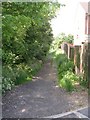
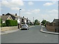

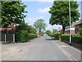

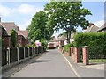
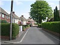
100 photos from this area
Area Information
Key information about the WF9 2SY including its size, population, and administrative classification.
- Area Type
- Postcode
- Area Size
- 2.7 hectares
- Population
- 1499
- Population Density
- 499 people/km²
House Prices in WF9 2SY
23
Properties
£203,820
Average Sold Price
£70,000
Lowest Price
£395,000
Highest Price
Showing 23 properties
| Address | Type | Beds | Baths | Last Sale Price | Last Sale Date | |
|---|---|---|---|---|---|---|
| 22 Hemings Way, South Elmsall, Pontefract, WF9 2SY | Detached | 4 | 3 | £295,000 | May 2025 | |
| 3 Hemings Way, South Elmsall, Pontefract, WF9 2SY | Detached | 4 | 2 | £330,000 | Jan 2025 | |
| 26 Hemings Way, South Elmsall, Pontefract, WF9 2SY | Detached | 4 | 3 | £395,000 | Sep 2023 | |
| 19 Hemings Way, South Elmsall, Pontefract, WF9 2SY | Detached | 4 | 2 | £330,000 | Jun 2023 | |
| 2 Hemings Way, South Elmsall, Pontefract, WF9 2SY | Detached | 4 | 2 | £375,000 | Sep 2022 | |
| 24 Hemings Way, South Elmsall, Pontefract, WF9 2SY | Detached | 4 | 2 | £278,000 | Aug 2022 | |
| 8 Hemings Way, South Elmsall, Pontefract, WF9 2SY | Detached | 4 | 1 | £262,500 | Mar 2022 | |
| 14 Hemings Way, South Elmsall, Pontefract, WF9 2SY | Detached | - | - | £177,500 | Mar 2007 | |
| 12 Hemings Way, South Elmsall, Pontefract, WF9 2SY | house | - | - | £167,995 | Mar 2005 | |
| 10 Hemings Way, South Elmsall, Pontefract, WF9 2SY | Detached | - | - | £167,995 | Jul 2004 |
Page 1 of 3
Energy Efficiency in WF9 2SY
Amenities
Schools
| Rank | School | Type | Entry gender | Ages |
|---|
Explore more schools in this area
Go to Schools tabDemographics
Household Size
Two person
most common
Accommodation Type
Houses
most common
Tenure
80
majority
Ethnic Group
White
most common
Religion
N/A
most common
Household Composition
N/A
most common
Age
47
median
Adults (30-64 years)
most common
Household Deprivation
N/A
with no deprivation
NS-SEC
27
in Lower managerial occupations
Explore more demographic insights in this area
Go to Demographics tabPlanning
Planning Constraints
- Flood RiskPremium
- Ramsar Wetland SitesPremium
- Area of Outstanding Natural BeautyPremium
- Protected Nature ReservePremium
- Protected WoodlandPremium