Area Overview for WF9 2FJ
Photos of WF9 2FJ
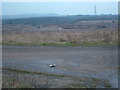
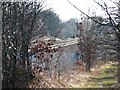
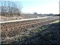
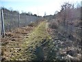
20 photos from this area
Area Information
Key information about the WF9 2FJ including its size, population, and administrative classification.
- Area Type
- Postcode
- Area Size
- 1.1 hectares
- Population
- 2348
- Population Density
- 1299 people/km²
House Prices in WF9 2FJ
42
Properties
£149,841
Average Sold Price
£102,995
Lowest Price
£220,000
Highest Price
Showing 42 properties
| Address | Type | Beds | Baths | Last Sale Price | Last Sale Date | |
|---|---|---|---|---|---|---|
| 21 Kestrel Way, South Elmsall, Pontefract, WF9 2FJ | Semi-detached | 3 | 2 | £220,000 | Apr 2025 | |
| 43 Kestrel Way, South Elmsall, Pontefract, WF9 2FJ | house | - | - | £158,000 | Feb 2025 | |
| 41 Kestrel Way, South Elmsall, Pontefract, WF9 2FJ | Semi-detached | 3 | 1 | £170,000 | Jun 2024 | |
| 34 Kestrel Way, South Elmsall, Pontefract, WF9 2FJ | Detached | 3 | 3 | £210,000 | Feb 2023 | |
| 22 Kestrel Way, South Elmsall, Pontefract, WF9 2FJ | Semi-detached | 3 | 2 | £190,000 | Dec 2022 | |
| 3 Kestrel Way, South Elmsall, Pontefract, WF9 2FJ | Semi-detached | 2 | 1 | £155,000 | Dec 2022 | |
| 37 Kestrel Way, South Elmsall, Pontefract, WF9 2FJ | Detached | 3 | 1 | £185,000 | Jun 2022 | |
| 14 Kestrel Way, South Elmsall, Pontefract, WF9 2FJ | Semi-detached | 4 | 3 | £182,500 | Oct 2021 | |
| 10 Kestrel Way, South Elmsall, Pontefract, WF9 2FJ | Semi-detached | 3 | 1 | £170,000 | Jul 2021 | |
| 24 Kestrel Way, South Elmsall, Pontefract, WF9 2FJ | house | - | - | £165,000 | Mar 2021 |
Page 1 of 5
Energy Efficiency in WF9 2FJ
Amenities
Schools
| Rank | School | Type | Entry gender | Ages |
|---|
Explore more schools in this area
Go to Schools tabDemographics
Household Size
Family (3-5 people)
most common
Accommodation Type
Houses
most common
Tenure
54
majority
Ethnic Group
White
most common
Religion
N/A
most common
Household Composition
N/A
most common
Age
47
median
Adults (30-64 years)
most common
Household Deprivation
N/A
with no deprivation
NS-SEC
22
in Lower managerial occupations
Explore more demographic insights in this area
Go to Demographics tabPlanning
Planning Constraints
- Flood RiskPremium
- Ramsar Wetland SitesPremium
- Area of Outstanding Natural BeautyPremium
- Protected Nature ReservePremium
- Protected WoodlandPremium