Area Overview for WF9 1NT
Photos of WF9 1NT
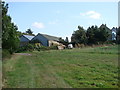
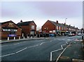
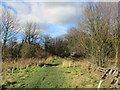
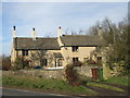
54 photos from this area
Area Information
Key information about the WF9 1NT including its size, population, and administrative classification.
- Area Type
- Postcode
- Area Size
- 2.2 hectares
- Population
- 1794
- Population Density
- 260 people/km²
House Prices in WF9 1NT
43
Properties
£131,456
Average Sold Price
£56,995
Lowest Price
£300,000
Highest Price
Showing 43 properties
| Address | Type | Beds | Baths | Last Sale Price | Last Sale Date | |
|---|---|---|---|---|---|---|
| 29 Orchid Crest, Upton, Pontefract, WF9 1NT | Detached | 3 | 1 | £200,000 | Dec 2023 | |
| 17 Orchid Crest, Upton, Pontefract, WF9 1NT | Detached | 4 | 3 | £290,000 | Nov 2023 | |
| 47 Orchid Crest, Upton, Pontefract, WF9 1NT | Detached | 4 | 3 | £285,000 | Aug 2023 | |
| 19 Orchid Crest, Upton, Pontefract, WF9 1NT | Detached | 4 | 2 | £300,000 | Mar 2023 | |
| 77 Orchid Crest, Upton, Pontefract, WF9 1NT | house | - | - | £215,000 | Apr 2021 | |
| 61 Orchid Crest, Upton, Pontefract, WF9 1NT | house | - | - | £175,000 | Nov 2020 | |
| 6 Orchid Crest, Upton, Pontefract, WF9 1NT | house | 4 | 1 | £180,000 | Feb 2020 | |
| 79 Orchid Crest, Upton, Pontefract, WF9 1NT | Detached | 3 | 2 | £155,000 | Oct 2019 | |
| 51 Orchid Crest, Upton, Pontefract, WF9 1NT | Detached | 3 | 2 | £160,000 | May 2019 | |
| 67 Orchid Crest, Upton, Pontefract, WF9 1NT | house | 4 | 2 | £180,000 | Oct 2018 |
Page 1 of 5
Energy Efficiency in WF9 1NT
Amenities
Schools
| Rank | School | Type | Entry gender | Ages |
|---|
Explore more schools in this area
Go to Schools tabDemographics
Household Size
Family (3-5 people)
most common
Accommodation Type
Houses
most common
Tenure
70
majority
Ethnic Group
White
most common
Religion
N/A
most common
Household Composition
N/A
most common
Age
47
median
Adults (30-64 years)
most common
Household Deprivation
N/A
with no deprivation
NS-SEC
30
in Lower managerial occupations
Explore more demographic insights in this area
Go to Demographics tabPlanning
Planning Constraints
- Flood RiskPremium
- Ramsar Wetland SitesPremium
- Area of Outstanding Natural BeautyPremium
- Protected Nature ReservePremium
- Protected WoodlandPremium