Area Overview for WF9 1NR
Photos of WF9 1NR
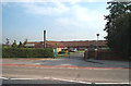
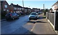
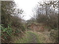
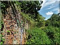
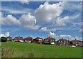
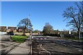
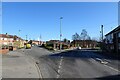
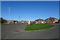
20 photos from this area
Area Information
Key information about the WF9 1NR including its size, population, and administrative classification.
- Area Type
- Postcode
- Area Size
- 1.6 hectares
- Population
- 1465
- Population Density
- 1215 people/km²
House Prices in WF9 1NR
36
Properties
£113,286
Average Sold Price
£43,000
Lowest Price
£205,000
Highest Price
Showing 36 properties
| Address | Type | Beds | Baths | Last Sale Price | Last Sale Date | |
|---|---|---|---|---|---|---|
| 9 Elder Avenue, Upton, Pontefract, WF9 1NR | Detached | 3 | 1 | £205,000 | Sep 2025 | |
| 28 Elder Avenue, Upton, Pontefract, WF9 1NR | Bungalow | 2 | 1 | £160,000 | Jun 2024 | |
| 44 Elder Avenue, Upton, Pontefract, WF9 1NR | house | - | - | £150,000 | Aug 2020 | |
| 14 Elder Avenue, Upton, Pontefract, WF9 1NR | Bungalow | 4 | 2 | £115,000 | Jan 2020 | |
| 30 Elder Avenue, Upton, Pontefract, WF9 1NR | Bungalow | 2 | 1 | £135,000 | Sep 2019 | |
| 26 Elder Avenue, Upton, Pontefract, WF9 1NR | Bungalow | 2 | 1 | £100,000 | Aug 2019 | |
| 34 Elder Avenue, Upton, Pontefract, WF9 1NR | Bungalow | 2 | 1 | £125,000 | Apr 2019 | |
| 16 Elder Avenue, Upton, Pontefract, WF9 1NR | Detached | 3 | 1 | £130,000 | Mar 2019 | |
| 42 Elder Avenue, Upton, Pontefract, WF9 1NR | Detached | 3 | 1 | £140,000 | Jan 2018 | |
| 27 Elder Avenue, Upton, Pontefract, WF9 1NR | Detached | 4 | 2 | £155,000 | Nov 2017 |
Page 1 of 4
Energy Efficiency in WF9 1NR
Amenities
Schools
| Rank | School | Type | Entry gender | Ages |
|---|
Explore more schools in this area
Go to Schools tabDemographics
Household Size
Two person
most common
Accommodation Type
Houses
most common
Tenure
75
majority
Ethnic Group
White
most common
Religion
N/A
most common
Household Composition
N/A
most common
Age
47
median
Adults (30-64 years)
most common
Household Deprivation
N/A
with no deprivation
NS-SEC
25
in Lower managerial occupations
Explore more demographic insights in this area
Go to Demographics tabPlanning
Planning Constraints
- Flood RiskPremium
- Ramsar Wetland SitesPremium
- Area of Outstanding Natural BeautyPremium
- Protected Nature ReservePremium
- Protected WoodlandPremium