Area Overview for WF9 1FR
Photos of WF9 1FR
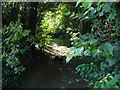
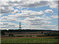
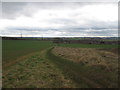
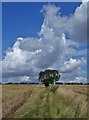
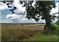
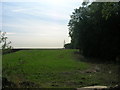

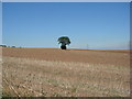
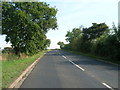

14 photos from this area
Area Information
Key information about the WF9 1FR including its size, population, and administrative classification.
- Area Type
- Postcode
- Area Size
- 21.5 hectares
- Population
- 1573
- Population Density
- 4188 people/km²
House Prices in WF9 1FR
54
Properties
£129,357
Average Sold Price
£94,995
Lowest Price
£173,000
Highest Price
Showing 54 properties
| Address | Type | Beds | Baths | Last Sale Price | Last Sale Date | |
|---|---|---|---|---|---|---|
| 50 Woodland Walk, Upton, Pontefract, WF9 1FR | Detached | 3 | 1 | £170,000 | Dec 2025 | |
| 17 Woodland Walk, Upton, Pontefract, WF9 1FR | house | - | - | £160,000 | Jun 2025 | |
| 11 Woodland Walk, Upton, Pontefract, WF9 1FR | Semi-detached | 2 | 1 | £145,000 | May 2025 | |
| 32 Woodland Walk, Upton, Pontefract, WF9 1FR | Detached | 2 | 1 | £145,000 | Mar 2025 | |
| 12 Woodland Walk, Upton, Pontefract, WF9 1FR | Semi-detached | 3 | 1 | £160,000 | Aug 2024 | |
| 29 Woodland Walk, Upton, Pontefract, WF9 1FR | Semi-detached | 2 | 2 | £125,000 | Feb 2024 | |
| 42 Woodland Walk, Upton, Pontefract, WF9 1FR | Semi-detached | 2 | 2 | £135,000 | Feb 2024 | |
| 9 Woodland Walk, Upton, Pontefract, WF9 1FR | Semi-detached | 2 | 1 | £140,000 | Jan 2024 | |
| 21 Woodland Walk, Upton, Pontefract, WF9 1FR | Semi-detached | 3 | 1 | £154,000 | Dec 2023 | |
| 10 Woodland Walk, Upton, Pontefract, WF9 1FR | Semi-detached | 2 | 1 | £135,000 | Jun 2023 |
Page 1 of 6
Energy Efficiency in WF9 1FR
Amenities
Schools
| Rank | School | Type | Entry gender | Ages |
|---|
Explore more schools in this area
Go to Schools tabDemographics
Household Size
Family (3-5 people)
most common
Accommodation Type
Houses
most common
Tenure
58
majority
Ethnic Group
White
most common
Religion
N/A
most common
Household Composition
N/A
most common
Age
47
median
Adults (30-64 years)
most common
Household Deprivation
N/A
with no deprivation
NS-SEC
17
in Lower managerial occupations
Explore more demographic insights in this area
Go to Demographics tabPlanning
Planning Constraints
- Flood RiskPremium
- Ramsar Wetland SitesPremium
- Area of Outstanding Natural BeautyPremium
- Protected Nature ReservePremium
- Protected WoodlandPremium