Area Overview for WF8 3RW
Photos of WF8 3RW
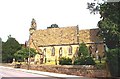

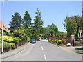

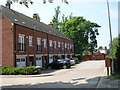
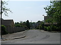


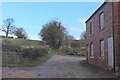
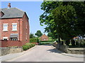
42 photos from this area
Area Information
Key information about the WF8 3RW including its size, population, and administrative classification.
- Area Type
- Postcode
- Area Size
- 2.3 hectares
- Population
- 1715
- Population Density
- 1045 people/km²
House Prices in WF8 3RW
19
Properties
£216,881
Average Sold Price
£53,333
Lowest Price
£370,000
Highest Price
Showing 19 properties
| Address | Type | Beds | Baths | Last Sale Price | Last Sale Date | |
|---|---|---|---|---|---|---|
| Highmoor Lodge, Carleton Road, Pontefract, WF8 3RW | Detached | 4 | 1 | £370,000 | Jul 2019 | |
| 2, The Lilacs, Carleton Road, Pontefract, WF8 3RW | Terraced | 3 | 1 | £175,000 | Jan 2017 | |
| White House, Carleton Road, Pontefract, WF8 3RW | Detached | 5 | 2 | £178,000 | Oct 2014 | |
| Holly Lodge, Carleton Road, Pontefract, WF8 3RW | Detached | - | - | £349,950 | Mar 2011 | |
| 1, The Lilacs, Carleton Road, Pontefract, WF8 3RW | house | - | - | £175,000 | Nov 2009 | |
| Amesbury, Carleton Road, Pontefract, WF8 3RW | Detached | - | - | £53,333 | Mar 1998 | |
| York House, Carleton Road, Pontefract, WF8 3RW | Detached | 6 | 5 | - | - | |
| Willow House, Carleton Road, Pontefract, WF8 3RW | Detached | 4 | 3 | - | - | |
| Lilac Cottages, Carleton Road, Pontefract, WF8 3RW | Detached | 4 | 2 | - | - | |
| THE LILACS, CARLETON ROAD, Pontefract, WF8 3RW | Flat | - | - | - | - |
Page 1 of 2
Energy Efficiency in WF8 3RW
Amenities
Schools
| Rank | School | Type | Entry gender | Ages |
|---|
Explore more schools in this area
Go to Schools tabDemographics
Household Size
Family (3-5 people)
most common
Accommodation Type
Houses
most common
Tenure
48
majority
Ethnic Group
White
most common
Religion
N/A
most common
Household Composition
N/A
most common
Age
47
median
Adults (30-64 years)
most common
Household Deprivation
N/A
with no deprivation
NS-SEC
22
in Lower managerial occupations
Explore more demographic insights in this area
Go to Demographics tabPlanning
Planning Constraints
- Flood RiskPremium
- Ramsar Wetland SitesPremium
- Area of Outstanding Natural BeautyPremium
- Protected Nature ReservePremium
- Protected WoodlandPremium