Area Overview for WF8 3AR
Photos of WF8 3AR
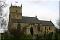
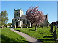
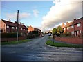
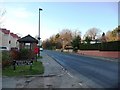
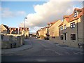
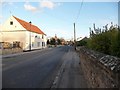
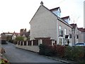
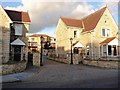

66 photos from this area
Area Information
Key information about the WF8 3AR including its size, population, and administrative classification.
- Area Type
- Postcode
- Area Size
- 4.7 hectares
- Population
- 1561
- Population Density
- 109 people/km²
House Prices in WF8 3AR
27
Properties
£161,375
Average Sold Price
£53,000
Lowest Price
£295,000
Highest Price
Showing 27 properties
| Address | Type | Beds | Baths | Last Sale Price | Last Sale Date | |
|---|---|---|---|---|---|---|
| 35 Sotheron Croft, Darrington, Pontefract, WF8 3AR | Bungalow | 2 | 1 | £240,000 | Jun 2023 | |
| 42 Sotheron Croft, Darrington, Pontefract, WF8 3AR | Bungalow | 2 | - | £295,000 | Oct 2021 | |
| 41 Sotheron Croft, Darrington, Pontefract, WF8 3AR | Bungalow | - | - | £275,000 | Sep 2020 | |
| 31 Sotheron Croft, Darrington, Pontefract, WF8 3AR | house | - | - | £200,000 | Jun 2019 | |
| 40 Sotheron Croft, Darrington, Pontefract, WF8 3AR | Bungalow | 2 | 1 | £190,000 | Oct 2017 | |
| 21 Sotheron Croft, Darrington, Pontefract, WF8 3AR | Semi-detached | 3 | 1 | £165,000 | Apr 2017 | |
| 25 Sotheron Croft, Darrington, Pontefract, WF8 3AR | Semi-detached | 3 | 1 | £155,000 | Mar 2015 | |
| 1 Sotheron Croft, Darrington, Pontefract, WF8 3AR | house | - | - | £100,000 | Mar 2015 | |
| 15 Sotheron Croft, Darrington, Pontefract, WF8 3AR | Semi-detached | - | - | £53,000 | Aug 2001 | |
| 29 Sotheron Croft, Darrington, Pontefract, WF8 3AR | Terraced | - | - | £62,500 | May 2001 |
Page 1 of 3
Energy Efficiency in WF8 3AR
Amenities
Schools
| Rank | School | Type | Entry gender | Ages |
|---|
Explore more schools in this area
Go to Schools tabDemographics
Household Size
Two person
most common
Accommodation Type
Houses
most common
Tenure
83
majority
Ethnic Group
White
most common
Religion
N/A
most common
Household Composition
N/A
most common
Age
47
median
Adults (30-64 years)
most common
Household Deprivation
N/A
with no deprivation
NS-SEC
41
in Lower managerial occupations
Explore more demographic insights in this area
Go to Demographics tabPlanning
Planning Constraints
- Flood RiskPremium
- Ramsar Wetland SitesPremium
- Area of Outstanding Natural BeautyPremium
- Protected Nature ReservePremium
- Protected WoodlandPremium