Area Overview for WF8 2NE
Photos of WF8 2NE

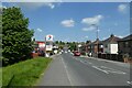
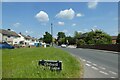
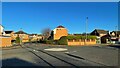
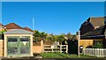
54 photos from this area
Area Information
Key information about the WF8 2NE including its size, population, and administrative classification.
- Area Type
- Postcode
- Area Size
- 1.1 hectares
- Population
- 1713
- Population Density
- 158863 people/km²
House Prices in WF8 2NE
29
Properties
£98,833
Average Sold Price
£63,000
Lowest Price
£155,500
Highest Price
Showing 29 properties
| Address | Type | Beds | Baths | Last Sale Price | Last Sale Date | |
|---|---|---|---|---|---|---|
| 156 Holmfield Close, Pontefract, WF8 2NE | Semi-detached | 4 | 1 | £155,500 | Aug 2023 | |
| 113 Holmfield Close, Pontefract, WF8 2NE | house | - | - | £142,000 | Apr 2023 | |
| 166 Holmfield Close, Pontefract, WF8 2NE | house | - | - | £100,000 | Nov 2021 | |
| 115 Holmfield Close, Pontefract, WF8 2NE | house | - | - | £96,000 | Mar 2017 | |
| 162 Holmfield Close, Pontefract, WF8 2NE | Semi-detached | 3 | 1 | £81,000 | May 2016 | |
| 160 Holmfield Close, Pontefract, WF8 2NE | Semi-detached | 3 | 1 | £81,000 | Dec 2015 | |
| 117 Holmfield Close, Pontefract, WF8 2NE | house | - | - | £71,000 | Jul 2014 | |
| 109 Holmfield Close, Pontefract, WF8 2NE | Semi-detached | - | - | £63,000 | Apr 2012 | |
| 99 Holmfield Close, Pontefract, WF8 2NE | house | - | - | £100,000 | Jan 2008 | |
| 180 Holmfield Close, Pontefract, WF8 2NE | Land | - | - | - | - |
Page 1 of 3
Energy Efficiency in WF8 2NE
Amenities
Schools
| Rank | School | Type | Entry gender | Ages |
|---|
Explore more schools in this area
Go to Schools tabDemographics
Household Size
Family (3-5 people)
most common
Accommodation Type
Houses
most common
Tenure
62
majority
Ethnic Group
White
most common
Religion
N/A
most common
Household Composition
N/A
most common
Age
47
median
Adults (30-64 years)
most common
Household Deprivation
N/A
with no deprivation
NS-SEC
22
in Lower managerial occupations
Explore more demographic insights in this area
Go to Demographics tabPlanning
Planning Constraints
- Flood RiskPremium
- Ramsar Wetland SitesPremium
- Area of Outstanding Natural BeautyPremium
- Protected Nature ReservePremium
- Protected WoodlandPremium