Area Overview for WF7 7JJ
Photos of WF7 7JJ

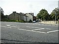
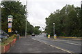
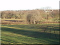
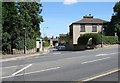
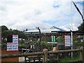
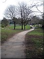
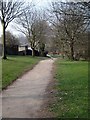
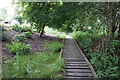
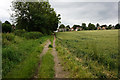
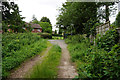
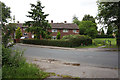
100 photos from this area
Area Information
Key information about the WF7 7JJ including its size, population, and administrative classification.
- Area Type
- Postcode
- Area Size
- 1.4 hectares
- Population
- 1331
- Population Density
- 2870 people/km²
House Prices in WF7 7JJ
35
Properties
£130,898
Average Sold Price
£41,000
Lowest Price
£280,000
Highest Price
Showing 35 properties
| Address | Type | Beds | Baths | Last Sale Price | Last Sale Date | |
|---|---|---|---|---|---|---|
| 79 Bell Lane, Ackworth, Pontefract, WF7 7JJ | Terraced | 2 | 1 | £183,000 | Jun 2025 | |
| Glynhome, Bell Lane, Ackworth, Pontefract, WF7 7JJ | Semi-detached | 3 | 1 | £200,000 | Dec 2024 | |
| 53 Bell Lane, Ackworth, Pontefract, WF7 7JJ | Terraced | 2 | 1 | £180,000 | Aug 2024 | |
| 49 Bell Lane, Ackworth, Pontefract, WF7 7JJ | Terraced | 2 | 1 | £141,000 | Oct 2022 | |
| Navano Bungalow, Bell Lane, Ackworth, Pontefract, WF7 7JJ | Bungalow | 3 | 1 | £280,000 | Sep 2022 | |
| 2, Bluebell Court, Bell Lane, Ackworth, Pontefract, WF7 7JJ | Semi-detached | 2 | 1 | £205,000 | Aug 2022 | |
| 55 Bell Lane, Ackworth, Pontefract, WF7 7JJ | Terraced | 2 | 1 | £156,000 | Jul 2022 | |
| 65 Bell Lane, Ackworth, Pontefract, WF7 7JJ | Terraced | 2 | 1 | £119,000 | Feb 2021 | |
| 57 Bell Lane, Ackworth, Pontefract, WF7 7JJ | Terraced | 2 | 1 | £118,000 | Mar 2020 | |
| 47 Bell Lane, Ackworth, Pontefract, WF7 7JJ | house | 2 | 1 | £115,000 | Jul 2019 |
Page 1 of 4
Energy Efficiency in WF7 7JJ
Amenities
Schools
| Rank | School | Type | Entry gender | Ages |
|---|
Explore more schools in this area
Go to Schools tabDemographics
Household Size
Two person
most common
Accommodation Type
Houses
most common
Tenure
85
majority
Ethnic Group
White
most common
Religion
N/A
most common
Household Composition
N/A
most common
Age
47
median
Adults (30-64 years)
most common
Household Deprivation
N/A
with no deprivation
NS-SEC
37
in Lower managerial occupations
Explore more demographic insights in this area
Go to Demographics tabPlanning
Planning Constraints
- Flood RiskPremium
- Ramsar Wetland SitesPremium
- Area of Outstanding Natural BeautyPremium
- Protected Nature ReservePremium
- Protected WoodlandPremium