Area Overview for WF7 7DU
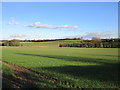
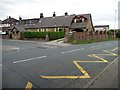
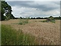
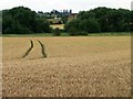
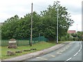
Photos of WF7 7DU
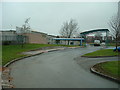

![Charlestown Estate [south east] in WF7 7DU](https://images.propbar.co.uk/images/geograph/25/02/2502807_120.jpg)
![Charlestown Estate [south west] in WF7 7DU](https://images.propbar.co.uk/images/geograph/25/02/2502811_120.jpg)

18 photos from this area
Area Information
Key information about the WF7 7DU including its size, population, and administrative classification.
- Area Type
- Postcode
- Area Size
- 15.9 hectares
- Population
- 1875
- Population Density
- 1021 people/km²
House Prices in WF7 7DU
53
Properties
£163,607
Average Sold Price
£30,000
Lowest Price
£390,000
Highest Price
Showing 53 properties
| Address | Type | Beds | Baths | Last Sale Price | Last Sale Date | |
|---|---|---|---|---|---|---|
| 37 Charlestown, Ackworth, Pontefract, WF7 7DU | Semi-detached | 3 | 1 | £195,000 | Sep 2025 | |
| 7 Charlestown, Ackworth, Pontefract, WF7 7DU | Semi-detached | 3 | 1 | £350,000 | Feb 2025 | |
| 18 Charlestown, Ackworth, Pontefract, WF7 7DU | Detached | 5 | 2 | £390,000 | Apr 2020 | |
| 31 Charlestown, Ackworth, Pontefract, WF7 7DU | Semi-detached | 3 | 1 | £164,000 | Mar 2019 | |
| 29 Charlestown, Ackworth, Pontefract, WF7 7DU | Semi-detached | 2 | 1 | £150,000 | Sep 2018 | |
| 42 Charlestown, Ackworth, Pontefract, WF7 7DU | Semi-detached | 3 | 1 | £146,000 | May 2017 | |
| 10 Charlestown, Ackworth, Pontefract, WF7 7DU | Semi-detached | 3 | 2 | £180,000 | Mar 2017 | |
| 13 Charlestown, Ackworth, Pontefract, WF7 7DU | Semi-detached | 3 | 2 | £165,000 | Oct 2016 | |
| 43 Charlestown, Ackworth, Pontefract, WF7 7DU | Detached | 3 | 2 | £178,000 | Feb 2016 | |
| 34 Charlestown, Ackworth, Pontefract, WF7 7DU | Semi-detached | 2 | - | £114,000 | Dec 2015 |
Page 1 of 6
Energy Efficiency in WF7 7DU
Amenities
Schools
| Rank | School | Type | Entry gender | Ages |
|---|
Explore more schools in this area
Go to Schools tabDemographics
Household Size
Two person
most common
Accommodation Type
Houses
most common
Tenure
65
majority
Ethnic Group
White
most common
Religion
N/A
most common
Household Composition
N/A
most common
Age
47
median
Adults (30-64 years)
most common
Household Deprivation
N/A
with no deprivation
NS-SEC
30
in Lower managerial occupations
Explore more demographic insights in this area
Go to Demographics tabPlanning
Planning Constraints
- Flood RiskPremium
- Ramsar Wetland SitesPremium
- Area of Outstanding Natural BeautyPremium
- Protected Nature ReservePremium
- Protected WoodlandPremium