Area Overview for WF6 2DL
Photos of WF6 2DL
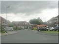
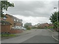
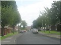
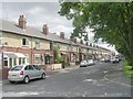
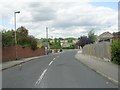
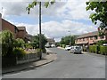
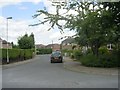
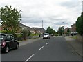
62 photos from this area
Area Information
Key information about the WF6 2DL including its size, population, and administrative classification.
- Area Type
- Postcode
- Area Size
- 7726 m²
- Population
- 1477
- Population Density
- 7617 people/km²
House Prices in WF6 2DL
21
Properties
£124,785
Average Sold Price
£49,995
Lowest Price
£225,000
Highest Price
Showing 21 properties
| Address | Type | Beds | Baths | Last Sale Price | Last Sale Date | |
|---|---|---|---|---|---|---|
| 16 Redruth Drive, Normanton, WF6 2DL | Semi-detached | 2 | 1 | £167,500 | Feb 2025 | |
| 17 Redruth Drive, Normanton, WF6 2DL | house | - | - | £225,000 | Sep 2023 | |
| 15 Redruth Drive, Normanton, WF6 2DL | house | - | - | £170,000 | May 2022 | |
| 3 Redruth Drive, Normanton, WF6 2DL | Bungalow | - | - | £130,000 | Oct 2020 | |
| 11 Redruth Drive, Normanton, WF6 2DL | Semi-detached | 3 | 1 | £145,000 | Sep 2019 | |
| 21 Redruth Drive, Normanton, WF6 2DL | Semi-detached | 3 | 1 | £148,000 | Feb 2019 | |
| 12 Redruth Drive, Normanton, WF6 2DL | Semi-detached | 3 | - | £125,000 | Aug 2015 | |
| 10 Redruth Drive, Normanton, WF6 2DL | Semi-detached | 3 | - | £125,000 | Apr 2014 | |
| 18 Redruth Drive, Normanton, WF6 2DL | house | 2 | - | £120,000 | Sep 2010 | |
| 1 Redruth Drive, Normanton, WF6 2DL | Detached | - | - | £93,000 | Jul 2009 |
Page 1 of 3
Energy Efficiency in WF6 2DL
Amenities
Schools
| Rank | School | Type | Entry gender | Ages |
|---|
Explore more schools in this area
Go to Schools tabDemographics
Household Size
Two person
most common
Accommodation Type
Houses
most common
Tenure
67
majority
Ethnic Group
White
most common
Religion
N/A
most common
Household Composition
N/A
most common
Age
47
median
Adults (30-64 years)
most common
Household Deprivation
N/A
with no deprivation
NS-SEC
22
in Lower managerial occupations
Explore more demographic insights in this area
Go to Demographics tabPlanning
Planning Constraints
- Flood RiskPremium
- Ramsar Wetland SitesPremium
- Area of Outstanding Natural BeautyPremium
- Protected Nature ReservePremium
- Protected WoodlandPremium