Area Overview for WF6 1UX
Photos of WF6 1UX
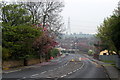

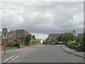
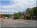


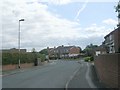


81 photos from this area
Area Information
Key information about the WF6 1UX including its size, population, and administrative classification.
- Area Type
- Postcode
- Area Size
- 4178 m²
- Population
- 2497
- Population Density
- 6045 people/km²
House Prices in WF6 1UX
15
Properties
£158,363
Average Sold Price
£58,995
Lowest Price
£280,000
Highest Price
Showing 15 properties
| Address | Type | Beds | Baths | Last Sale Price | Last Sale Date | |
|---|---|---|---|---|---|---|
| 14 Oakmont Close, Normanton, WF6 1UX | Terraced | 3 | 2 | £280,000 | Jul 2025 | |
| 9 Oakmont Close, Normanton, WF6 1UX | Semi-detached | 2 | 1 | £165,000 | Nov 2024 | |
| 15 Oakmont Close, Normanton, WF6 1UX | house | - | - | £135,000 | Dec 2021 | |
| 7 Oakmont Close, Normanton, WF6 1UX | Semi-detached | 2 | 1 | £159,000 | Sep 2021 | |
| 1 Oakmont Close, Normanton, WF6 1UX | Detached | 4 | - | £237,000 | Nov 2019 | |
| 3 Oakmont Close, Normanton, WF6 1UX | Detached | 3 | 1 | £183,000 | Mar 2018 | |
| 4 Oakmont Close, Normanton, WF6 1UX | house | - | - | £128,000 | Aug 2013 | |
| 6 Oakmont Close, Normanton, WF6 1UX | house | - | - | £145,000 | Sep 2009 | |
| 5 Oakmont Close, Normanton, WF6 1UX | Detached | - | - | £175,000 | Mar 2008 | |
| 11 Oakmont Close, Normanton, WF6 1UX | house | - | - | £135,000 | Sep 2007 |
Page 1 of 2
Energy Efficiency in WF6 1UX
Amenities
Schools
| Rank | School | Type | Entry gender | Ages |
|---|
Explore more schools in this area
Go to Schools tabDemographics
Household Size
Family (3-5 people)
most common
Accommodation Type
Houses
most common
Tenure
85
majority
Ethnic Group
White
most common
Religion
N/A
most common
Household Composition
N/A
most common
Age
47
median
Adults (30-64 years)
most common
Household Deprivation
N/A
with no deprivation
NS-SEC
36
in Lower managerial occupations
Explore more demographic insights in this area
Go to Demographics tabPlanning
Planning Constraints
- Flood RiskPremium
- Ramsar Wetland SitesPremium
- Area of Outstanding Natural BeautyPremium
- Protected Nature ReservePremium
- Protected WoodlandPremium