Area Overview for WF6 1TG
Photos of WF6 1TG


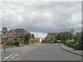
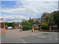


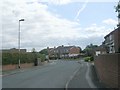

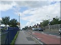

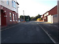
81 photos from this area
Area Information
Key information about the WF6 1TG including its size, population, and administrative classification.
- Area Type
- Postcode
- Area Size
- 9261 m²
- Population
- 2497
- Population Density
- 6045 people/km²
House Prices in WF6 1TG
37
Properties
£114,174
Average Sold Price
£38,000
Lowest Price
£225,000
Highest Price
Showing 37 properties
| Address | Type | Beds | Baths | Last Sale Price | Last Sale Date | |
|---|---|---|---|---|---|---|
| 15 Meadow Brook Close, Normanton, WF6 1TG | Semi-detached | 4 | 1 | £225,000 | Mar 2025 | |
| 41 Meadow Brook Close, Normanton, WF6 1TG | Semi-detached | 2 | 1 | £157,500 | Dec 2024 | |
| 26 Meadow Brook Close, Normanton, WF6 1TG | Semi-detached | 3 | 1 | £165,500 | Feb 2024 | |
| 2 Meadow Brook Close, Normanton, WF6 1TG | Semi-detached | 2 | 1 | £170,000 | Apr 2023 | |
| 17 Meadow Brook Close, Normanton, WF6 1TG | house | - | - | £140,000 | Sep 2021 | |
| 39 Meadow Brook Close, Normanton, WF6 1TG | Semi-detached | 2 | 1 | £136,000 | Aug 2021 | |
| 21 Meadow Brook Close, Normanton, WF6 1TG | house | 2 | 1 | £135,000 | May 2021 | |
| 29 Meadow Brook Close, Normanton, WF6 1TG | Semi-detached | 3 | - | £180,000 | Jan 2021 | |
| 19 Meadow Brook Close, Normanton, WF6 1TG | house | - | - | £130,000 | Jan 2021 | |
| 10 Meadow Brook Close, Normanton, WF6 1TG | Detached | 4 | 2 | £165,000 | Jan 2019 |
Page 1 of 4
Energy Efficiency in WF6 1TG
Amenities
Schools
| Rank | School | Type | Entry gender | Ages |
|---|
Explore more schools in this area
Go to Schools tabDemographics
Household Size
Family (3-5 people)
most common
Accommodation Type
Houses
most common
Tenure
85
majority
Ethnic Group
White
most common
Religion
N/A
most common
Household Composition
N/A
most common
Age
47
median
Adults (30-64 years)
most common
Household Deprivation
N/A
with no deprivation
NS-SEC
36
in Lower managerial occupations
Explore more demographic insights in this area
Go to Demographics tabPlanning
Planning Constraints
- Flood RiskPremium
- Ramsar Wetland SitesPremium
- Area of Outstanding Natural BeautyPremium
- Protected Nature ReservePremium
- Protected WoodlandPremium