Area Overview for WF4 4LT
Photos of WF4 4LT

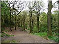
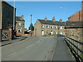
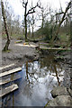
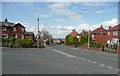
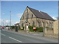
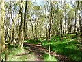
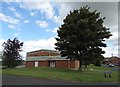
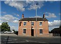
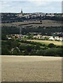
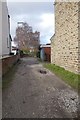

82 photos from this area
Area Information
Key information about the WF4 4LT including its size, population, and administrative classification.
- Area Type
- Postcode
- Area Size
- 21.6 hectares
- Population
- 1391
- Population Density
- 1453 people/km²
House Prices in WF4 4LT
39
Properties
£144,427
Average Sold Price
£39,000
Lowest Price
£260,000
Highest Price
Showing 39 properties
| Address | Type | Beds | Baths | Last Sale Price | Last Sale Date | |
|---|---|---|---|---|---|---|
| 20 Coxley View, Netherton, Wakefield, WF4 4LT | house | 2 | 1 | £178,000 | Mar 2025 | |
| 10 Coxley View, Netherton, Wakefield, WF4 4LT | Semi-detached | 3 | 2 | £260,000 | Feb 2025 | |
| 9 Coxley View, Netherton, Wakefield, WF4 4LT | house | - | - | £220,000 | May 2022 | |
| 38 Coxley View, Netherton, Wakefield, WF4 4LT | Semi-detached | 3 | 2 | £195,000 | Jul 2020 | |
| 52 Coxley View, Netherton, Wakefield, WF4 4LT | house | - | - | £112,500 | Apr 2017 | |
| 21 Coxley View, Netherton, Wakefield, WF4 4LT | Semi-detached | - | - | £126,500 | Aug 2007 | |
| 14 Coxley View, Netherton, Wakefield, WF4 4LT | Detached | 2 | 1 | £137,000 | Jul 2007 | |
| 13 Coxley View, Netherton, Wakefield, WF4 4LT | Semi-detached | - | - | £119,950 | Jul 2006 | |
| 19 Coxley View, Netherton, Wakefield, WF4 4LT | house | - | - | £107,500 | Jul 2006 | |
| 18 Coxley View, Netherton, Wakefield, WF4 4LT | Terraced | - | - | £124,650 | Jul 2005 |
Page 1 of 4
Energy Efficiency in WF4 4LT
Amenities
Schools
| Rank | School | Type | Entry gender | Ages |
|---|
Explore more schools in this area
Go to Schools tabDemographics
Household Size
Two person
most common
Accommodation Type
Houses
most common
Tenure
79
majority
Ethnic Group
White
most common
Religion
N/A
most common
Household Composition
N/A
most common
Age
47
median
Adults (30-64 years)
most common
Household Deprivation
N/A
with no deprivation
NS-SEC
36
in Lower managerial occupations
Explore more demographic insights in this area
Go to Demographics tabPlanning
Planning Constraints
- Flood RiskPremium
- Ramsar Wetland SitesPremium
- Area of Outstanding Natural BeautyPremium
- Protected Nature ReservePremium
- Protected WoodlandPremium