Area Overview for WF4 3PR
Photos of WF4 3PR

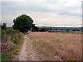


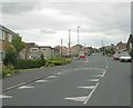


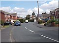

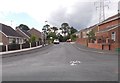

75 photos from this area
Area Information
Key information about the WF4 3PR including its size, population, and administrative classification.
- Area Type
- Postcode
- Area Size
- 2.2 hectares
- Population
- 2167
- Population Density
- 2593 people/km²
House Prices in WF4 3PR
67
Properties
£147,287
Average Sold Price
£49,950
Lowest Price
£320,000
Highest Price
Showing 67 properties
| Address | Type | Beds | Baths | Last Sale Price | Last Sale Date | |
|---|---|---|---|---|---|---|
| 74 Hollin Drive, Durkar, Wakefield, WF4 3PR | Bungalow | 3 | 2 | £260,000 | Sep 2025 | |
| 61 Hollin Drive, Durkar, Wakefield, WF4 3PR | Semi-detached | 3 | 2 | £230,000 | Jul 2025 | |
| 80A Hollin Drive, Durkar, Wakefield, WF4 3PR | Detached | 4 | 2 | £320,000 | Jun 2025 | |
| 79 Hollin Drive, Durkar, Wakefield, WF4 3PR | Semi-detached | 2 | 1 | £188,000 | Nov 2024 | |
| 114 Hollin Drive, Durkar, Wakefield, WF4 3PR | Bungalow | 2 | 1 | £237,000 | Aug 2024 | |
| 86 Hollin Drive, Durkar, Wakefield, WF4 3PR | Semi-detached | 2 | 1 | £190,000 | Jun 2024 | |
| 42 Hollin Drive, Durkar, Wakefield, WF4 3PR | Semi-detached | 3 | 1 | £222,500 | Feb 2024 | |
| 78 Hollin Drive, Durkar, Wakefield, WF4 3PR | Bungalow | - | - | £180,000 | Feb 2024 | |
| 70 Hollin Drive, Durkar, Wakefield, WF4 3PR | Semi-detached | 2 | 2 | £225,000 | Apr 2023 | |
| 44A Hollin Drive, Durkar, Wakefield, WF4 3PR | Semi-detached | 2 | 1 | £190,000 | Oct 2022 |
Page 1 of 7
Energy Efficiency in WF4 3PR
Amenities
Schools
| Rank | School | Type | Entry gender | Ages |
|---|
Explore more schools in this area
Go to Schools tabDemographics
Household Size
Two person
most common
Accommodation Type
Houses
most common
Tenure
85
majority
Ethnic Group
White
most common
Religion
N/A
most common
Household Composition
N/A
most common
Age
47
median
Adults (30-64 years)
most common
Household Deprivation
N/A
with no deprivation
NS-SEC
35
in Lower managerial occupations
Explore more demographic insights in this area
Go to Demographics tabPlanning
Planning Constraints
- Flood RiskPremium
- Ramsar Wetland SitesPremium
- Area of Outstanding Natural BeautyPremium
- Protected Nature ReservePremium
- Protected WoodlandPremium