Area Overview for WF4 3AT
Photos of WF4 3AT
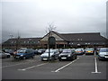
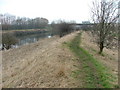
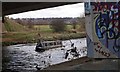

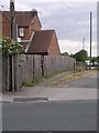
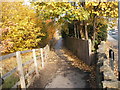
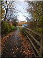
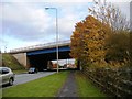
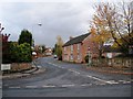
61 photos from this area
Area Information
Key information about the WF4 3AT including its size, population, and administrative classification.
- Area Type
- Postcode
- Area Size
- 6523 m²
- Population
- 2167
- Population Density
- 2593 people/km²
House Prices in WF4 3AT
11
Properties
£127,750
Average Sold Price
£47,000
Lowest Price
£250,000
Highest Price
Showing 11 properties
| Address | Type | Beds | Baths | Last Sale Price | Last Sale Date | |
|---|---|---|---|---|---|---|
| 443A Denby Dale Road East, Durkar, Wakefield, WF4 3AT | Detached | 3 | 2 | £250,000 | Jul 2024 | |
| 441 Denby Dale Road East, Durkar, Wakefield, WF4 3AT | house | - | - | £126,500 | Jun 2015 | |
| 429 Denby Dale Road East, Durkar, Wakefield, WF4 3AT | Detached | 3 | 2 | £87,500 | May 2001 | |
| 445 Denby Dale Road East, Durkar, Wakefield, WF4 3AT | Detached | 5 | - | £47,000 | Oct 1998 | |
| 443 Denby Dale Road East, Durkar, Wakefield, WF4 3AT | Semi-detached | 3 | 1 | - | - | |
| 437B Denby Dale Road East, Durkar, Wakefield, WF4 3AT | Semi-detached | 3 | 1 | - | - | |
| 437 Denby Dale Road East, Durkar, Wakefield, WF4 3AT | Bungalow | 3 | - | - | - | |
| 431 Denby Dale Road East, Durkar, Wakefield, WF4 3AT | Semi-detached | - | - | - | - | |
| 437A Denby Dale Road East, Durkar, Wakefield, WF4 3AT | Terraced | - | - | - | - | |
| 439A Denby Dale Road East, Durkar, Wakefield, WF4 3AT | house | - | - | - | - |
Page 1 of 2
Energy Efficiency in WF4 3AT
Amenities
Schools
| Rank | School | Type | Entry gender | Ages |
|---|
Explore more schools in this area
Go to Schools tabDemographics
Household Size
Two person
most common
Accommodation Type
Houses
most common
Tenure
85
majority
Ethnic Group
White
most common
Religion
N/A
most common
Household Composition
N/A
most common
Age
47
median
Adults (30-64 years)
most common
Household Deprivation
N/A
with no deprivation
NS-SEC
35
in Lower managerial occupations
Explore more demographic insights in this area
Go to Demographics tabPlanning
Planning Constraints
- Flood RiskPremium
- Ramsar Wetland SitesPremium
- Area of Outstanding Natural BeautyPremium
- Protected Nature ReservePremium
- Protected WoodlandPremium