Area Overview for WF4 2AX
Photos of WF4 2AX
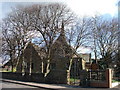
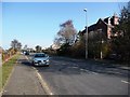
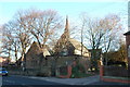
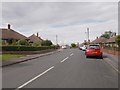
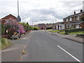
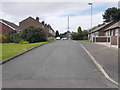
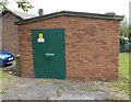
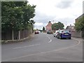
64 photos from this area
Area Information
Key information about the WF4 2AX including its size, population, and administrative classification.
- Area Type
- Postcode
- Area Size
- 1.3 hectares
- Population
- 1351
- Population Density
- 1082 people/km²
House Prices in WF4 2AX
32
Properties
£91,731
Average Sold Price
£15,000
Lowest Price
£170,000
Highest Price
Showing 32 properties
| Address | Type | Beds | Baths | Last Sale Price | Last Sale Date | |
|---|---|---|---|---|---|---|
| 27 Cow Lane, Ryhill, Wakefield, WF4 2AX | house | 3 | - | £70,000 | Nov 2023 | |
| 39 Cow Lane, Ryhill, Wakefield, WF4 2AX | Retail | 3 | 1 | £130,000 | May 2022 | |
| 29 Cow Lane, Ryhill, Wakefield, WF4 2AX | Semi-detached | 3 | 2 | £170,000 | Aug 2020 | |
| 9 Cow Lane, Ryhill, Wakefield, WF4 2AX | Semi-detached | 4 | 1 | £165,000 | Jun 2020 | |
| 23 Cow Lane, Ryhill, Wakefield, WF4 2AX | house | - | - | £116,000 | Jan 2019 | |
| 31 Cow Lane, Ryhill, Wakefield, WF4 2AX | house | 3 | - | £84,000 | Aug 2011 | |
| 21 Cow Lane, Ryhill, Wakefield, WF4 2AX | Semi-detached | 3 | 1 | £100,000 | Apr 2008 | |
| 7 Cow Lane, Ryhill, Wakefield, WF4 2AX | Terraced | 3 | - | £117,000 | Dec 2005 | |
| 37 Cow Lane, Ryhill, Wakefield, WF4 2AX | Semi-detached | - | - | £80,000 | Feb 2004 | |
| 19 Cow Lane, Ryhill, Wakefield, WF4 2AX | Semi-detached | - | - | £43,000 | Jan 2001 |
Page 1 of 4
Energy Efficiency in WF4 2AX
Amenities
Schools
| Rank | School | Type | Entry gender | Ages |
|---|
Explore more schools in this area
Go to Schools tabDemographics
Household Size
One person
most common
Accommodation Type
Houses
most common
Tenure
44
majority
Ethnic Group
White
most common
Religion
N/A
most common
Household Composition
N/A
most common
Age
47
median
Adults (30-64 years)
most common
Household Deprivation
N/A
with no deprivation
NS-SEC
16
in Lower managerial occupations
Explore more demographic insights in this area
Go to Demographics tabPlanning
Planning Constraints
- Flood RiskPremium
- Ramsar Wetland SitesPremium
- Area of Outstanding Natural BeautyPremium
- Protected Nature ReservePremium
- Protected WoodlandPremium