Area Overview for WF3 4JX
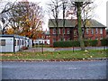
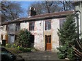
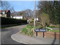
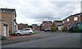
Photos of WF3 4JX
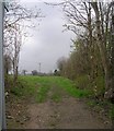
![City Fields, Wakefield East [1] in WF3 4JX](https://images.propbar.co.uk/images/geograph/47/42/4742034_120.jpg)
100 photos from this area
Area Information
Key information about the WF3 4JX including its size, population, and administrative classification.
- Area Type
- Postcode
- Area Size
- 1.3 hectares
- Population
- 1574
- Population Density
- 2574 people/km²
House Prices in WF3 4JX
36
Properties
£171,717
Average Sold Price
£39,950
Lowest Price
£345,000
Highest Price
Showing 36 properties
| Address | Type | Beds | Baths | Last Sale Price | Last Sale Date | |
|---|---|---|---|---|---|---|
| 25 Ash Street, Stanley, Wakefield, WF3 4JX | Terraced | 2 | 1 | £177,000 | Dec 2024 | |
| 29 Ash Street, Stanley, Wakefield, WF3 4JX | Terraced | 2 | 1 | £183,000 | Oct 2024 | |
| 39 Ash Street, Stanley, Wakefield, WF3 4JX | Semi-detached | 3 | 1 | £280,000 | Dec 2023 | |
| 8 Ash Street, Stanley, Wakefield, WF3 4JX | Semi-detached | 2 | 1 | £265,000 | Oct 2023 | |
| 6 Ash Street, Stanley, Wakefield, WF3 4JX | Bungalow | - | - | £210,000 | Mar 2023 | |
| 31 Ash Street, Stanley, Wakefield, WF3 4JX | Terraced | 3 | 1 | £200,000 | Sep 2022 | |
| 11 Ash Street, Stanley, Wakefield, WF3 4JX | house | - | - | £345,000 | Mar 2021 | |
| 32 Ash Street, Stanley, Wakefield, WF3 4JX | Semi-detached | 4 | 1 | £218,000 | Oct 2020 | |
| 18 Ash Street, Stanley, Wakefield, WF3 4JX | Bungalow | 3 | 1 | £300,000 | Oct 2018 | |
| 1 Ash Street, Stanley, Wakefield, WF3 4JX | Terraced | 2 | 1 | £174,000 | Jun 2017 |
Page 1 of 4
Energy Efficiency in WF3 4JX
Amenities
Schools
| Rank | School | Type | Entry gender | Ages |
|---|
Explore more schools in this area
Go to Schools tabDemographics
Household Size
Two person
most common
Accommodation Type
Houses
most common
Tenure
78
majority
Ethnic Group
White
most common
Religion
N/A
most common
Household Composition
N/A
most common
Age
47
median
Adults (30-64 years)
most common
Household Deprivation
N/A
with no deprivation
NS-SEC
41
in Lower managerial occupations
Explore more demographic insights in this area
Go to Demographics tabPlanning
Planning Constraints
- Flood RiskPremium
- Ramsar Wetland SitesPremium
- Area of Outstanding Natural BeautyPremium
- Protected Nature ReservePremium
- Protected WoodlandPremium