Area Overview for WF3 4GS
Photos of WF3 4GS
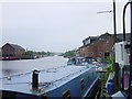
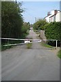
![City Fields, Wakefield East [11] in WF3 4GS](https://images.propbar.co.uk/images/geograph/48/51/4851511_120.jpg)
100 photos from this area
Area Information
Key information about the WF3 4GS including its size, population, and administrative classification.
- Area Type
- Postcode
- Area Size
- 2.1 hectares
- Population
- 2404
- Population Density
- 603 people/km²
House Prices in WF3 4GS
14
Properties
£268,400
Average Sold Price
£140,569
Lowest Price
£409,995
Highest Price
Showing 14 properties
| Address | Type | Beds | Baths | Last Sale Price | Last Sale Date | |
|---|---|---|---|---|---|---|
| 5 Mallard Walk, Stanley, Wakefield, WF3 4GS | house | - | - | £267,995 | Jun 2024 | |
| 9 Mallard Walk, Stanley, Wakefield, WF3 4GS | house | - | - | £409,995 | May 2024 | |
| 1 Mallard Walk, Stanley, Wakefield, WF3 4GS | house | - | - | £262,995 | Mar 2024 | |
| 7 Mallard Walk, Stanley, Wakefield, WF3 4GS | house | - | - | £263,495 | Mar 2024 | |
| 11 Mallard Walk, Stanley, Wakefield, WF3 4GS | house | - | - | £314,995 | Mar 2024 | |
| 15 Mallard Walk, Stanley, Wakefield, WF3 4GS | house | - | - | £314,995 | Mar 2024 | |
| 17 Mallard Walk, Stanley, Wakefield, WF3 4GS | house | - | - | £140,569 | Aug 2023 | |
| 19 Mallard Walk, Stanley, Wakefield, WF3 4GS | house | - | - | £140,569 | Aug 2023 | |
| 8 Mallard Walk, Stanley, Wakefield, WF3 4GS | house | - | - | £299,995 | Aug 2023 | |
| 6 Mallard Walk, Stanley, Wakefield, WF3 4GS | house | - | - | - | - |
Page 1 of 2
Energy Efficiency in WF3 4GS
Amenities
Schools
| Rank | School | Type | Entry gender | Ages |
|---|
Explore more schools in this area
Go to Schools tabDemographics
Household Size
Two person
most common
Accommodation Type
Houses
most common
Tenure
68
majority
Ethnic Group
White
most common
Religion
N/A
most common
Household Composition
N/A
most common
Age
47
median
Adults (30-64 years)
most common
Household Deprivation
N/A
with no deprivation
NS-SEC
40
in Lower managerial occupations
Explore more demographic insights in this area
Go to Demographics tabPlanning
Planning Constraints
- Flood RiskPremium
- Ramsar Wetland SitesPremium
- Area of Outstanding Natural BeautyPremium
- Protected Nature ReservePremium
- Protected WoodlandPremium