Area Overview for WF3 4AD
Photos of WF3 4AD
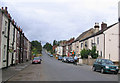
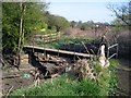
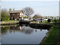

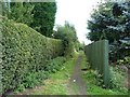
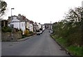
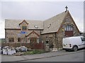

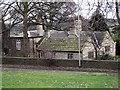
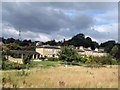

100 photos from this area
Area Information
Key information about the WF3 4AD including its size, population, and administrative classification.
- Area Type
- Postcode
- Area Size
- 9265 m²
- Population
- 2404
- Population Density
- 603 people/km²
House Prices in WF3 4AD
17
Properties
£147,333
Average Sold Price
£60,000
Lowest Price
£312,000
Highest Price
Showing 17 properties
| Address | Type | Beds | Baths | Last Sale Price | Last Sale Date | |
|---|---|---|---|---|---|---|
| 409 Aberford Road, Stanley, Wakefield, WF3 4AD | Terraced | 2 | 1 | £200,000 | Jun 2023 | |
| 393 Aberford Road, Stanley, Wakefield, WF3 4AD | Terraced | 3 | 2 | £225,000 | Dec 2021 | |
| 395 Aberford Road, Stanley, Wakefield, WF3 4AD | Terraced | 2 | 1 | £150,000 | Oct 2020 | |
| 407 Aberford Road, Stanley, Wakefield, WF3 4AD | Detached | 4 | 3 | £312,000 | Dec 2019 | |
| 417 Aberford Road, Stanley, Wakefield, WF3 4AD | Terraced | 2 | 1 | £120,000 | Aug 2019 | |
| 411 Aberford Road, Stanley, Wakefield, WF3 4AD | house | 3 | 1 | £145,000 | Dec 2015 | |
| 413 Aberford Road, Stanley, Wakefield, WF3 4AD | Cottage | 2 | 1 | £114,500 | Aug 2015 | |
| 415 Aberford Road, Stanley, Wakefield, WF3 4AD | house | - | - | £137,500 | Feb 2006 | |
| 391 Aberford Road, Stanley, Wakefield, WF3 4AD | Terraced | 2 | 1 | £90,000 | May 2003 | |
| 389 Aberford Road, Stanley, Wakefield, WF3 4AD | Terraced | - | - | £60,000 | Jul 2001 |
Page 1 of 2
Energy Efficiency in WF3 4AD
Amenities
Schools
| Rank | School | Type | Entry gender | Ages |
|---|
Explore more schools in this area
Go to Schools tabDemographics
Household Size
Two person
most common
Accommodation Type
Houses
most common
Tenure
68
majority
Ethnic Group
White
most common
Religion
N/A
most common
Household Composition
N/A
most common
Age
47
median
Adults (30-64 years)
most common
Household Deprivation
N/A
with no deprivation
NS-SEC
40
in Lower managerial occupations
Explore more demographic insights in this area
Go to Demographics tabPlanning
Planning Constraints
- Flood RiskPremium
- Ramsar Wetland SitesPremium
- Area of Outstanding Natural BeautyPremium
- Protected Nature ReservePremium
- Protected WoodlandPremium