Area Overview for WF3 2JS
Photos of WF3 2JS
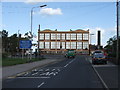
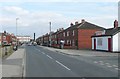
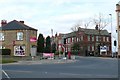
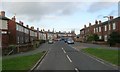
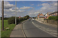
79 photos from this area
Area Information
Key information about the WF3 2JS including its size, population, and administrative classification.
- Area Type
- Postcode
- Area Size
- 8770 m²
- Population
- 2046
- Population Density
- 1360 people/km²
House Prices in WF3 2JS
13
Properties
£226,557
Average Sold Price
£122,500
Lowest Price
£402,000
Highest Price
Showing 13 properties
| Address | Type | Beds | Baths | Last Sale Price | Last Sale Date | |
|---|---|---|---|---|---|---|
| Lyndale, Woodhouse Lane, East Ardsley, Wakefield, WF3 2JS | Semi-detached | 3 | 2 | £230,000 | Aug 2025 | |
| Avon Dale, Woodhouse Lane, East Ardsley, Wakefield, WF3 2JS | Semi-detached | 3 | 1 | £210,000 | Jul 2020 | |
| Prospect House, Woodhouse Lane, East Ardsley, Wakefield, WF3 2JS | Semi-detached | 3 | 1 | £258,400 | Mar 2019 | |
| Healey Croft, Woodhouse Lane, East Ardsley, Wakefield, WF3 2JS | Detached | 4 | 2 | £402,000 | Jul 2016 | |
| Ashlea, Woodhouse Lane, East Ardsley, Wakefield, WF3 2JS | Semi-detached | 4 | 2 | £193,000 | Sep 2007 | |
| West Dale, Woodhouse Lane, East Ardsley, Wakefield, WF3 2JS | Detached | - | - | £170,000 | Jul 2004 | |
| Woodleigh, Woodhouse Lane, East Ardsley, Wakefield, WF3 2JS | Detached | - | - | £122,500 | Oct 1998 | |
| Mayfield House Care Home, Woodhouse Lane, East Ardsley, Wakefield, WF3 2JS | Semi-detached | 3 | 1 | - | - | |
| Gayster, Woodhouse Lane, East Ardsley, Wakefield, WF3 2JS | Detached | - | - | - | - | |
| Shemara, Woodhouse Lane, East Ardsley, Wakefield, WF3 2JS | house | - | - | - | - |
Page 1 of 2
Energy Efficiency in WF3 2JS
Amenities
Schools
| Rank | School | Type | Entry gender | Ages |
|---|
Explore more schools in this area
Go to Schools tabDemographics
Household Size
Two person
most common
Accommodation Type
Houses
most common
Tenure
74
majority
Ethnic Group
White
most common
Religion
N/A
most common
Household Composition
N/A
most common
Age
47
median
Adults (30-64 years)
most common
Household Deprivation
N/A
with no deprivation
NS-SEC
30
in Lower managerial occupations
Explore more demographic insights in this area
Go to Demographics tabPlanning
Planning Constraints
- Flood RiskPremium
- Ramsar Wetland SitesPremium
- Area of Outstanding Natural BeautyPremium
- Protected Nature ReservePremium
- Protected WoodlandPremium