Area Overview for WF3 1UZ
Photos of WF3 1UZ


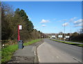
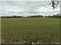
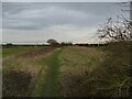
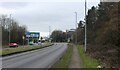


45 photos from this area
Area Information
Key information about the WF3 1UZ including its size, population, and administrative classification.
- Area Type
- Postcode
- Area Size
- 1.3 hectares
- Population
- 1428
- Population Density
- 5262 people/km²
House Prices in WF3 1UZ
28
Properties
£211,863
Average Sold Price
£106,000
Lowest Price
£371,000
Highest Price
Showing 28 properties
| Address | Type | Beds | Baths | Last Sale Price | Last Sale Date | |
|---|---|---|---|---|---|---|
| 19 Poppleton Drive, West Ardsley, Wakefield, WF3 1UZ | Detached | 4 | 2 | £371,000 | May 2021 | |
| 4 Poppleton Drive, West Ardsley, Wakefield, WF3 1UZ | Detached | 4 | 3 | £286,000 | Mar 2018 | |
| 14 Poppleton Drive, West Ardsley, Wakefield, WF3 1UZ | Detached | 4 | 1 | £265,000 | Nov 2017 | |
| 24 Poppleton Drive, West Ardsley, Wakefield, WF3 1UZ | house | - | - | £180,000 | Mar 2016 | |
| 3 Poppleton Drive, West Ardsley, Wakefield, WF3 1UZ | Detached | 4 | - | £235,000 | Jun 2014 | |
| 23 Poppleton Drive, West Ardsley, Wakefield, WF3 1UZ | house | - | - | £222,500 | May 2013 | |
| 1 Poppleton Drive, West Ardsley, Wakefield, WF3 1UZ | house | - | - | £246,000 | Aug 2011 | |
| 7 Poppleton Drive, West Ardsley, Wakefield, WF3 1UZ | house | - | - | £210,000 | Nov 2010 | |
| 18 Poppleton Drive, West Ardsley, Wakefield, WF3 1UZ | Detached | - | - | £250,000 | Jun 2009 | |
| 11 Poppleton Drive, West Ardsley, Wakefield, WF3 1UZ | Detached | - | - | £225,000 | Oct 2006 |
Page 1 of 3
Energy Efficiency in WF3 1UZ
Amenities
Schools
| Rank | School | Type | Entry gender | Ages |
|---|
Explore more schools in this area
Go to Schools tabDemographics
Household Size
Family (3-5 people)
most common
Accommodation Type
Houses
most common
Tenure
93
majority
Ethnic Group
White
most common
Religion
N/A
most common
Household Composition
N/A
most common
Age
47
median
Adults (30-64 years)
most common
Household Deprivation
N/A
with no deprivation
NS-SEC
48
in Lower managerial occupations
Explore more demographic insights in this area
Go to Demographics tabPlanning
Planning Constraints
- Flood RiskPremium
- Ramsar Wetland SitesPremium
- Area of Outstanding Natural BeautyPremium
- Protected Nature ReservePremium
- Protected WoodlandPremium