Area Overview for WF3 1BB
Photos of WF3 1BB

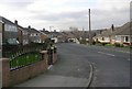
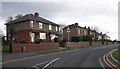

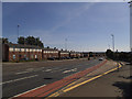
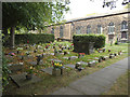
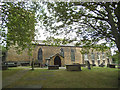
91 photos from this area
Area Information
Key information about the WF3 1BB including its size, population, and administrative classification.
- Area Type
- Postcode
- Area Size
- 1.0 hectares
- Population
- 1714
- Population Density
- 1574 people/km²
House Prices in WF3 1BB
17
Properties
£240,499
Average Sold Price
£62,000
Lowest Price
£480,000
Highest Price
Showing 17 properties
| Address | Type | Beds | Baths | Last Sale Price | Last Sale Date | |
|---|---|---|---|---|---|---|
| 384 Westerton Road, Tingley, Wakefield, WF3 1BB | Detached | 4 | 1 | £312,500 | Apr 2024 | |
| 386 Westerton Road, Tingley, Wakefield, WF3 1BB | Bungalow | 2 | 1 | £480,000 | Apr 2024 | |
| 475 Westerton Road, Tingley, Wakefield, WF3 1BB | Semi-detached | 3 | 3 | £220,000 | Jun 2023 | |
| 471 Westerton Road, Tingley, Wakefield, WF3 1BB | Bungalow | - | - | £210,000 | Nov 2020 | |
| Fairfield House, Westerton Road, Tingley, Wakefield, WF3 1BB | Detached | 3 | - | £440,000 | Sep 2016 | |
| 394 Westerton Road, Tingley, Wakefield, WF3 1BB | house | - | - | £100,000 | May 2016 | |
| 469 Westerton Road, Tingley, Wakefield, WF3 1BB | Bungalow | 2 | 1 | £179,995 | Jun 2005 | |
| 392 Westerton Road, Tingley, Wakefield, WF3 1BB | Detached | - | - | £160,000 | Mar 2005 | |
| 390 Westerton Road, Tingley, Wakefield, WF3 1BB | Detached | - | - | £62,000 | Sep 1996 | |
| 473 Westerton Road, Tingley, Wakefield, WF3 1BB | Detached | 2 | - | - | - |
Page 1 of 2
Energy Efficiency in WF3 1BB
Amenities
Schools
| Rank | School | Type | Entry gender | Ages |
|---|
Explore more schools in this area
Go to Schools tabDemographics
Household Size
Family (3-5 people)
most common
Accommodation Type
Houses
most common
Tenure
88
majority
Ethnic Group
White
most common
Religion
N/A
most common
Household Composition
N/A
most common
Age
47
median
Adults (30-64 years)
most common
Household Deprivation
N/A
with no deprivation
NS-SEC
43
in Lower managerial occupations
Explore more demographic insights in this area
Go to Demographics tabPlanning
Planning Constraints
- Flood RiskPremium
- Ramsar Wetland SitesPremium
- Area of Outstanding Natural BeautyPremium
- Protected Nature ReservePremium
- Protected WoodlandPremium