Area Overview for WF2 9BL
Photos of WF2 9BL
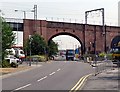
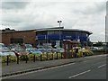
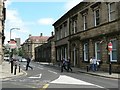
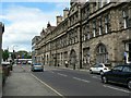
100 photos from this area
Area Information
Key information about the WF2 9BL including its size, population, and administrative classification.
- Area Type
- Postcode
- Area Size
- 1.8 hectares
- Population
- 1864
- Population Density
- 1940 people/km²
House Prices in WF2 9BL
23
Properties
£98,056
Average Sold Price
£32,500
Lowest Price
£160,000
Highest Price
Showing 23 properties
| Address | Type | Beds | Baths | Last Sale Price | Last Sale Date | |
|---|---|---|---|---|---|---|
| 69 Dewsbury Road, Wakefield, WF2 9BL | Terraced | 2 | 1 | £150,000 | Jan 2025 | |
| 49 Dewsbury Road, Wakefield, WF2 9BL | Terraced | 2 | 1 | £160,000 | Jul 2023 | |
| 73 Dewsbury Road, Wakefield, WF2 9BL | Terraced | 2 | 2 | £110,000 | Oct 2022 | |
| 37 Dewsbury Road, Wakefield, WF2 9BL | Terraced | 1 | - | £132,000 | Sep 2017 | |
| 41 Dewsbury Road, Wakefield, WF2 9BL | house | 2 | 1 | £82,000 | May 2015 | |
| 45 Dewsbury Road, Wakefield, WF2 9BL | Terraced | 3 | 1 | £105,000 | Oct 2014 | |
| 77 Dewsbury Road, Wakefield, WF2 9BL | Terraced | 2 | - | £64,000 | Sep 2014 | |
| 75 Dewsbury Road, Wakefield, WF2 9BL | Terraced | 2 | 1 | £47,000 | Feb 2002 | |
| 51 Dewsbury Road, Wakefield, WF2 9BL | Terraced | - | - | £32,500 | Nov 1995 | |
| 79 Dewsbury Road, Wakefield, WF2 9BL | Terraced | 2 | 1 | - | - |
Page 1 of 3
Energy Efficiency in WF2 9BL
Amenities
Schools
| Rank | School | Type | Entry gender | Ages |
|---|
Explore more schools in this area
Go to Schools tabDemographics
Household Size
One person
most common
Accommodation Type
Houses
most common
Tenure
46
majority
Ethnic Group
White
most common
Religion
N/A
most common
Household Composition
N/A
most common
Age
47
median
Adults (30-64 years)
most common
Household Deprivation
N/A
with no deprivation
NS-SEC
21
in Lower managerial occupations
Explore more demographic insights in this area
Go to Demographics tabPlanning
Planning Constraints
- Flood RiskPremium
- Ramsar Wetland SitesPremium
- Area of Outstanding Natural BeautyPremium
- Protected Nature ReservePremium
- Protected WoodlandPremium