Area Overview for WF2 0UU
Photos of WF2 0UU

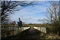

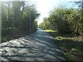
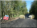
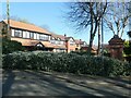

33 photos from this area
Area Information
Key information about the WF2 0UU including its size, population, and administrative classification.
- Area Type
- Postcode
- Area Size
- 2.1 hectares
- Population
- 1565
- Population Density
- 423 people/km²
House Prices in WF2 0UU
13
Properties
£320,528
Average Sold Price
£146,000
Lowest Price
£460,000
Highest Price
Showing 13 properties
| Address | Type | Beds | Baths | Last Sale Price | Last Sale Date | |
|---|---|---|---|---|---|---|
| 3 Tudor Lawns, Carr Gate, Wakefield, WF2 0UU | house | - | - | £460,000 | Jan 2021 | |
| 1 Tudor Lawns, Carr Gate, Wakefield, WF2 0UU | Detached | 4 | 3 | £428,250 | Mar 2020 | |
| 12 Tudor Lawns, Carr Gate, Wakefield, WF2 0UU | house | 4 | - | £385,000 | Apr 2019 | |
| The Oaks, Tudor Lawns, Carr Gate, Wakefield, WF2 0UU | house | - | - | £420,000 | Aug 2018 | |
| 8 Tudor Lawns, Carr Gate, Wakefield, WF2 0UU | house | 4 | - | £340,000 | Dec 2011 | |
| 10 Tudor Lawns, Carr Gate, Wakefield, WF2 0UU | Detached | 4 | - | £301,000 | Nov 2005 | |
| 9 Tudor Lawns, Carr Gate, Wakefield, WF2 0UU | Terraced | - | - | £247,000 | Dec 2002 | |
| 11 Tudor Lawns, Carr Gate, Wakefield, WF2 0UU | Detached | 4 | 3 | £157,500 | Jul 1998 | |
| 4 Tudor Lawns, Carr Gate, Wakefield, WF2 0UU | Detached | - | - | £146,000 | Jul 1997 | |
| 6 Tudor Lawns, Carr Gate, Wakefield, WF2 0UU | Detached | - | - | - | - |
Page 1 of 2
Energy Efficiency in WF2 0UU
Amenities
Schools
| Rank | School | Type | Entry gender | Ages |
|---|
Explore more schools in this area
Go to Schools tabDemographics
Household Size
Two person
most common
Accommodation Type
Houses
most common
Tenure
85
majority
Ethnic Group
White
most common
Religion
N/A
most common
Household Composition
N/A
most common
Age
47
median
Adults (30-64 years)
most common
Household Deprivation
N/A
with no deprivation
NS-SEC
37
in Lower managerial occupations
Explore more demographic insights in this area
Go to Demographics tabPlanning
Planning Constraints
- Flood RiskPremium
- Ramsar Wetland SitesPremium
- Area of Outstanding Natural BeautyPremium
- Protected Nature ReservePremium
- Protected WoodlandPremium