Area Overview for WF2 0JS
Photos of WF2 0JS
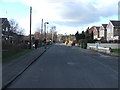

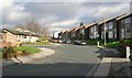
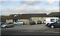
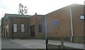
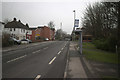
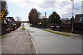
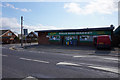
100 photos from this area
Area Information
Key information about the WF2 0JS including its size, population, and administrative classification.
- Area Type
- Postcode
- Area Size
- 1.5 hectares
- Population
- 1386
- Population Density
- 4962 people/km²
House Prices in WF2 0JS
30
Properties
£157,040
Average Sold Price
£42,000
Lowest Price
£257,000
Highest Price
Showing 30 properties
| Address | Type | Beds | Baths | Last Sale Price | Last Sale Date | |
|---|---|---|---|---|---|---|
| 117 Wrenthorpe Road, Wakefield, WF2 0JS | house | - | - | £185,500 | Mar 2021 | |
| 84 Wrenthorpe Road, Wakefield, WF2 0JS | Detached | 4 | - | £208,000 | Dec 2019 | |
| 70 Wrenthorpe Road, Wakefield, WF2 0JS | house | - | - | £257,000 | Oct 2019 | |
| 82 Wrenthorpe Road, Wakefield, WF2 0JS | Detached | 3 | 1 | £198,000 | May 2019 | |
| 104 Wrenthorpe Road, Wakefield, WF2 0JS | Terraced | 3 | 1 | £133,000 | Jun 2017 | |
| 129 Wrenthorpe Road, Wakefield, WF2 0JS | house | - | - | £195,000 | Mar 2012 | |
| 86 Wrenthorpe Road, Wakefield, WF2 0JS | house | 4 | - | £192,000 | May 2011 | |
| 102 Wrenthorpe Road, Wakefield, WF2 0JS | Terraced | 2 | 1 | £129,950 | Dec 2007 | |
| 92 Wrenthorpe Road, Wakefield, WF2 0JS | Terraced | - | - | £154,950 | Oct 2007 | |
| 74 Wrenthorpe Road, Wakefield, WF2 0JS | Detached | 5 | 5 | £249,950 | Jul 2007 |
Page 1 of 3
Energy Efficiency in WF2 0JS
Amenities
Schools
| Rank | School | Type | Entry gender | Ages |
|---|
Explore more schools in this area
Go to Schools tabDemographics
Household Size
Two person
most common
Accommodation Type
Houses
most common
Tenure
88
majority
Ethnic Group
White
most common
Religion
N/A
most common
Household Composition
N/A
most common
Age
47
median
Adults (30-64 years)
most common
Household Deprivation
N/A
with no deprivation
NS-SEC
42
in Lower managerial occupations
Explore more demographic insights in this area
Go to Demographics tabPlanning
Planning Constraints
- Flood RiskPremium
- Ramsar Wetland SitesPremium
- Area of Outstanding Natural BeautyPremium
- Protected Nature ReservePremium
- Protected WoodlandPremium