Area Overview for WF2 0FU
Photos of WF2 0FU
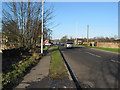
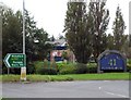
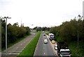
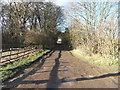
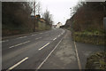
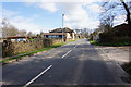
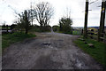
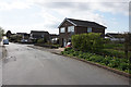
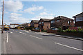
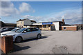
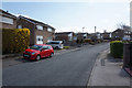
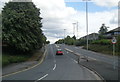
62 photos from this area
Area Information
Key information about the WF2 0FU including its size, population, and administrative classification.
- Area Type
- Postcode
- Area Size
- 3.6 hectares
- Population
- 1565
- Population Density
- 423 people/km²
House Prices in WF2 0FU
49
Properties
£261,823
Average Sold Price
£196,850
Lowest Price
£395,000
Highest Price
Showing 49 properties
| Address | Type | Beds | Baths | Last Sale Price | Last Sale Date | |
|---|---|---|---|---|---|---|
| 39 Wren Green Way, Wrenthorpe, Wakefield, WF2 0FU | Semi-detached | 3 | 2 | £270,000 | Jul 2024 | |
| 20 Wren Green Way, Wrenthorpe, Wakefield, WF2 0FU | Semi-detached | 3 | 2 | £255,000 | Jul 2024 | |
| 11 Wren Green Way, Wrenthorpe, Wakefield, WF2 0FU | Semi-detached | 3 | 2 | £262,500 | Nov 2023 | |
| 9 Wren Green Way, Wrenthorpe, Wakefield, WF2 0FU | Detached | 4 | 2 | £382,500 | Jun 2023 | |
| 34 Wren Green Way, Wrenthorpe, Wakefield, WF2 0FU | house | - | - | £377,500 | May 2023 | |
| 52 Wren Green Way, Wrenthorpe, Wakefield, WF2 0FU | house | - | - | £210,000 | Nov 2022 | |
| 50 Wren Green Way, Wrenthorpe, Wakefield, WF2 0FU | house | - | - | £215,000 | Nov 2022 | |
| 18 Wren Green Way, Wrenthorpe, Wakefield, WF2 0FU | Semi-detached | 3 | 2 | £250,000 | Sep 2022 | |
| 27 Wren Green Way, Wrenthorpe, Wakefield, WF2 0FU | Retail | 3 | - | £230,000 | Jun 2022 | |
| 36 Wren Green Way, Wrenthorpe, Wakefield, WF2 0FU | Retail | 4 | 3 | £395,000 | May 2022 |
Page 1 of 5
Energy Efficiency in WF2 0FU
Amenities
Schools
| Rank | School | Type | Entry gender | Ages |
|---|
Explore more schools in this area
Go to Schools tabDemographics
Household Size
Two person
most common
Accommodation Type
Houses
most common
Tenure
85
majority
Ethnic Group
White
most common
Religion
N/A
most common
Household Composition
N/A
most common
Age
47
median
Adults (30-64 years)
most common
Household Deprivation
N/A
with no deprivation
NS-SEC
37
in Lower managerial occupations
Explore more demographic insights in this area
Go to Demographics tabPlanning
Planning Constraints
- Flood RiskPremium
- Ramsar Wetland SitesPremium
- Area of Outstanding Natural BeautyPremium
- Protected Nature ReservePremium
- Protected WoodlandPremium