Area Overview for WF2 0BE
Photos of WF2 0BE
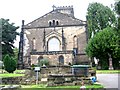
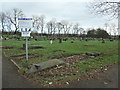
![Commonwealth war grave in Alverthorpe churchyard [1] in WF2 0BE](https://images.propbar.co.uk/images/geograph/60/87/6087836_120.jpg)
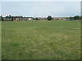
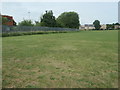
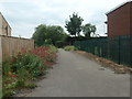
100 photos from this area
Area Information
Key information about the WF2 0BE including its size, population, and administrative classification.
- Area Type
- Postcode
- Area Size
- 1994 m²
- Population
- 1869
- Population Density
- 3316 people/km²
House Prices in WF2 0BE
5
Properties
£69,124
Average Sold Price
£24,000
Lowest Price
£107,500
Highest Price
Showing 5 properties
| Address | Type | Beds | Baths | Last Sale Price | Last Sale Date | |
|---|---|---|---|---|---|---|
| 8 Light Lane, Wakefield, WF2 0BE | house | - | - | £107,500 | Jan 2021 | |
| 6 Light Lane, Wakefield, WF2 0BE | Terraced | 2 | 1 | £55,000 | May 2019 | |
| 4 Light Lane, Wakefield, WF2 0BE | Terraced | - | - | £24,000 | May 1999 | |
| 3 Light Lane, Wakefield, WF2 0BE | house | - | - | £89,995 | Feb 1999 | |
| Jasmine Cottage, 1 Light Lane, Wakefield, WF2 0BE | Detached | 4 | 2 | - | - |
Energy Efficiency in WF2 0BE
Amenities
Schools
| Rank | School | Type | Entry gender | Ages |
|---|
Explore more schools in this area
Go to Schools tabDemographics
Household Size
Family (3-5 people)
most common
Accommodation Type
Houses
most common
Tenure
60
majority
Ethnic Group
White
most common
Religion
N/A
most common
Household Composition
N/A
most common
Age
47
median
Adults (30-64 years)
most common
Household Deprivation
N/A
with no deprivation
NS-SEC
26
in Lower managerial occupations
Explore more demographic insights in this area
Go to Demographics tabPlanning
Planning Constraints
- Flood RiskPremium
- Ramsar Wetland SitesPremium
- Area of Outstanding Natural BeautyPremium
- Protected Nature ReservePremium
- Protected WoodlandPremium