Area Overview for WF17 9HW
Photos of WF17 9HW
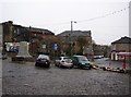
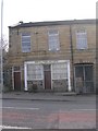
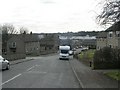
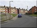
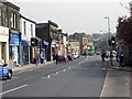
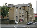
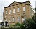
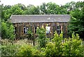
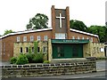
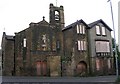
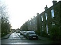
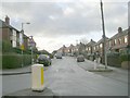
100 photos from this area
Area Information
Key information about the WF17 9HW including its size, population, and administrative classification.
- Area Type
- Postcode
- Area Size
- 2.6 hectares
- Population
- 1652
- Population Density
- 1779 people/km²
House Prices in WF17 9HW
46
Properties
£108,091
Average Sold Price
£15,360
Lowest Price
£200,000
Highest Price
Showing 46 properties
| Address | Type | Beds | Baths | Last Sale Price | Last Sale Date | |
|---|---|---|---|---|---|---|
| 97 High Street, Birstall, Batley, WF17 9HW | Terraced | 2 | 1 | £156,000 | Apr 2025 | |
| 123 High Street, Birstall, Batley, WF17 9HW | Terraced | 3 | 1 | £200,000 | Feb 2025 | |
| 101 High Street, Birstall, Batley, WF17 9HW | Terraced | 2 | 1 | £135,000 | Mar 2024 | |
| 121 High Street, Birstall, Batley, WF17 9HW | Terraced | 3 | 1 | £190,000 | Dec 2023 | |
| 79 High Street, Birstall, Batley, WF17 9HW | Semi-detached | 2 | 1 | £99,950 | Mar 2019 | |
| 56 High Street, Birstall, Batley, WF17 9HW | Terraced | - | - | £100,000 | Nov 2018 | |
| 100 High Street, Birstall, Batley, WF17 9HW | Semi-detached | - | - | £95,000 | May 2015 | |
| 99 High Street, Birstall, Batley, WF17 9HW | house | - | - | £81,000 | Mar 2013 | |
| 92 High Street, Birstall, Batley, WF17 9HW | Semi-detached | 2 | 1 | £58,000 | Apr 2011 | |
| 58 High Street, Birstall, Batley, WF17 9HW | house | 2 | 2 | £120,000 | Jul 2010 |
Page 1 of 5
Energy Efficiency in WF17 9HW
Amenities
Schools
| Rank | School | Type | Entry gender | Ages |
|---|
Explore more schools in this area
Go to Schools tabDemographics
Household Size
One person
most common
Accommodation Type
Houses
most common
Tenure
44
majority
Ethnic Group
White
most common
Religion
N/A
most common
Household Composition
N/A
most common
Age
47
median
Adults (30-64 years)
most common
Household Deprivation
N/A
with no deprivation
NS-SEC
23
in Lower managerial occupations
Explore more demographic insights in this area
Go to Demographics tabPlanning
Planning Constraints
- Flood RiskPremium
- Ramsar Wetland SitesPremium
- Area of Outstanding Natural BeautyPremium
- Protected Nature ReservePremium
- Protected WoodlandPremium